Search the Special Collections and Archives Portal
Search Results
#70287: UNLV seismology display as seen after the Caliente/Alamo Nevada centered earthquake May 22, 2015 at the University of Nevada, Las Vegas., 2015 May 22
Level of Description
File
Archival Collection
University of Nevada, Las Vegas Creative Services Records (2010s)
To request this item in person:
Collection Number: PH-00388-05
Collection Name: University of Nevada, Las Vegas Creative Services Records (2010s)
Box/Folder: Digital File 00
Collection Name: University of Nevada, Las Vegas Creative Services Records (2010s)
Box/Folder: Digital File 00
Archival Component
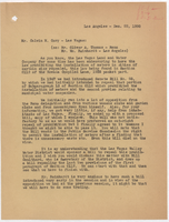
Letter from E. E. Bennett (Los Angeles) to Calvin M. Cory (Las Vegas), December 22, 1950
Date
1950-12-22
Archival Collection
Description
Discussion of the defeat of bills to overturn the metering prohibition and efforts to have a future bill passed. "80-8, 83-4, 80-5-Gen" written at head of page in red pencil.
Text
Rotary Club of Las Vegas of Las Vegas with Mark Mielke publicity, 1971 April 22
Level of Description
File
Archival Collection
Frank Mitrani Photographs
To request this item in person:
Collection Number: PH-00332
Collection Name: Frank Mitrani Photographs
Box/Folder: Box 16
Collection Name: Frank Mitrani Photographs
Box/Folder: Box 16
Archival Component
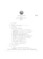
Meeting minutes for Consolidated Student Senate University of Nevada, Las Vegas, January 22, 1987
Date
1987-01-22
Archival Collection
Description
Includes meeting agenda and minutes. CSUN Session 17 Meeting Minutes and Agendas.
Text
#70222: Medical devises photographed for illustrative uses in conjunction with the UNLV Medical School April 22-23, 2015 at the University of Nevada, Las Vegas., 2015 April 22
Level of Description
File
Archival Collection
University of Nevada, Las Vegas Creative Services Records (2010s)
To request this item in person:
Collection Number: PH-00388-05
Collection Name: University of Nevada, Las Vegas Creative Services Records (2010s)
Box/Folder: Digital File 00
Collection Name: University of Nevada, Las Vegas Creative Services Records (2010s)
Box/Folder: Digital File 00
Archival Component
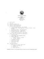
Meeting minutes for Consolidated Student Senate, University of Nevada, Las Vegas, March 22, 1983
Date
1983-03-22
Archival Collection
Description
Includes meeting agenda and minutes along with additional information about the transmitter site lease agreement. CSUN Session 13 (Part 1) Meeting Minutes and Agendas.
Text
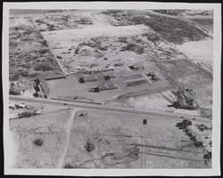
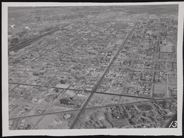
Photograph of an aerial view of Division I, Las Vegas (Nev.), January 22, 1947
Date
1947-01-22
Archival Collection
Description
Another aerial view of Division I in Las Vegas.
Image
Photograph of an aerial view of downtown, Las Vegas (Nev.), January 22, 1947
Date
1947-01-22
Archival Collection
Description
An aerial view of Las Vegas looking north but displaying the downtown area.
Image
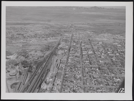
Photograph of an aerial view of downtown Las Vegas (Nev.), January 22, 1947
Date
1947-01-22
Archival Collection
Description
An aerial view of Las Vegas showing the downtown area while looking north.
Image
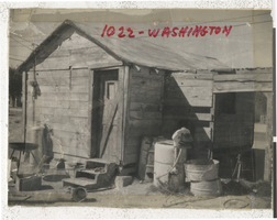
Photograph of a building on Washington St, Las Vegas (Nev.), September 22, 1960
Date
1960-09-22
Archival Collection
Description
Substandard building with buckets and other items scattered in the front dirt lot. This building was located at 1022 Washington in West Las Vegas. Street Address: 1022 Washington Street
Image
Pagination
Refine my results
Content Type
Creator or Contributor
Subject
Archival Collection
Digital Project
Resource Type
Year
Material Type
Place
Language
Records Classification
