Search Results
Frontier Strike: picketing, member meetings, and portraits, Culinary Union, Las Vegas (Nev.), 1990s (folder 1 of 2), image 12 (back)
Date
1990 to 1999
Description
Arrangement note: Series I. Demonstrations, Subseries I.A. Frontier Strike
Image

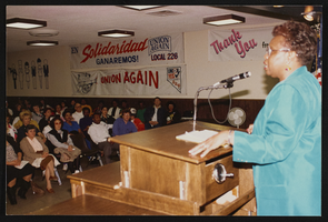
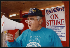
Frontier Strike: picketing, member meetings, and portraits, Culinary Union, Las Vegas (Nev.), 1990s (folder 1 of 2), image 13 (front)
Date
1990 to 1999
Description
Arrangement note: Series I. Demonstrations, Subseries I.A. Frontier Strike
Image

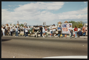
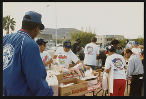
Frontier Strike: picketing, member meetings, and portraits, Culinary Union, Las Vegas (Nev.), 1990s (folder 1 of 2), image 14
Date
1990 to 1999
Description
Arrangement note: Series I. Demonstrations, Subseries I.A. Frontier Strike
Image

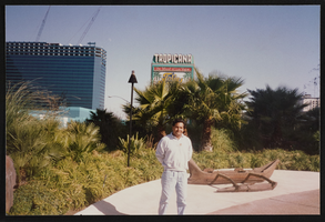
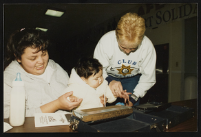
Frontier Strike: picketing, member meetings, and portraits, Culinary Union, Las Vegas (Nev.), 1990s (folder 1 of 2), image 15
Date
1990 to 1999
Description
Arrangement note: Series I. Demonstrations, Subseries I.A. Frontier Strike
Image
Frontier Strike: picketing, member meetings, and portraits, Culinary Union, Las Vegas (Nev.), 1990s (folder 1 of 2), image 16
Date
1990 to 1999
Description
Arrangement note: Series I. Demonstrations, Subseries I.A. Frontier Strike
Image
Frontier Strike: picketing, member meetings, and portraits, Culinary Union, Las Vegas (Nev.), 1990s (folder 1 of 2), image 17
Date
1990 to 1999
Description
Arrangement note: Series I. Demonstrations, Subseries I.A. Frontier Strike
Image
Frontier Strike: picketing, member meetings, and portraits, Culinary Union, Las Vegas (Nev.), 1990s (folder 1 of 2), image 18
Date
1990 to 1999
Description
Arrangement note: Series I. Demonstrations, Subseries I.A. Frontier Strike
Image
Frontier Strike: picketing, member meetings, and portraits, Culinary Union, Las Vegas (Nev.), 1990s (folder 1 of 2), image 19
Date
1990 to 1999
Description
Arrangement note: Series I. Demonstrations, Subseries I.A. Frontier Strike
Image
Frontier Strike: picketing, member meetings, and portraits, Culinary Union, Las Vegas (Nev.), 1990s (folder 1 of 2), image 20
Date
1990 to 1999
Description
Arrangement note: Series I. Demonstrations, Subseries I.A. Frontier Strike
Image
Frontier Strike: picketing, member meetings, and portraits, Culinary Union, Las Vegas (Nev.), 1990s (folder 1 of 2), image 21
Date
1990 to 1999
Description
Arrangement note: Series I. Demonstrations, Subseries I.A. Frontier Strike
Image