Search Results
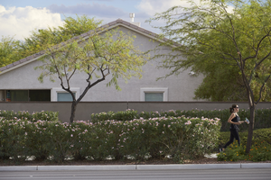
A home, traffic, and landscaping along West Sahara Avenue near Pavilion Center Drive, Las Vegas, Nevada: digital photograph
Date
2017-08-23
Archival Collection
Description
A strip of landscaping, used here by a runner, and a block wall are the only barriers between West Sahara Avenue and this house near Pavilion Center Drive.
Image

Bicyclist on the Western Beltway Trail near West Sahara Avenue, Las Vegas, Nevada: digital photograph
Date
2017-08-25
Archival Collection
Description
A lone bicyclist makes his way along the Western Beltway Trail near the I-215 The Beltway interchange at West Sahara Avenue.
Image

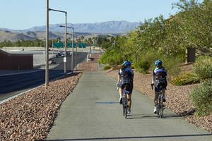
Bicyclists on the Western Beltway Trail near West Sahara Avenue, Las Vegas, Nevada: digital photograph
Date
2017-08-25
Archival Collection
Description
Bicyclists make their way along the Western Beltway Trail near the I-215 The Beltway interchange at West Sahara Avenue.
Image
Bicyclists on the Western Beltway Trail near West Sahara Avenue, Las Vegas, Nevada: digital photograph
Date
2017-08-25
Archival Collection
Description
Bicyclists make their way along the Western Beltway Trail near the I-215 The Beltway interchange at West Sahara Avenue.
Image
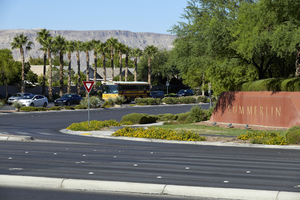
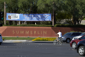
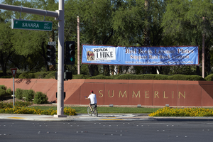
Traffic in front of Summerlin signage at South Hualapai Way and West Sahara Avenue looking south, Las Vegas, Nevada: digital photograph
Date
2017-08-25
Archival Collection
Description
A Summerlin monument sign marks the development's boundaries on South Hualapai Way at West Sahara Avenue.
Image
Traffic in front of Summerlin signage at South Hualapai Way and West Sahara Avenue looking south, Las Vegas, Nevada: digital photograph
Date
2017-08-25
Archival Collection
Description
A Summerlin monument sign marks the development's boundaries on South Hualapai Way at West Sahara Avenue.
Image
Traffic in front of Summerlin signage at South Hualapai Way and West Sahara Avenue looking south, Las Vegas, Nevada: digital photograph
Date
2017-08-25
Archival Collection
Description
A Summerlin monument sign marks the development's boundaries on South Hualapai Way at West Sahara Avenue.
Image
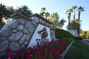
Peccole Ranch entrance looking north from West Sahara Avenue, Las Vegas, Nevada: digital photograph
Date
2017-08-27
Archival Collection
Description
Signage and landscaping marks the entrance Peccole Ranch near the intersection of West Sahara Avenue and South Grand Canyon Drive.
Image
Peccole Ranch entrance looking north from West Sahara Avenue, Las Vegas, Nevada: digital photograph
Date
2017-08-27
Archival Collection
Description
Signage and landscaping marks the entrance Peccole Ranch near the intersection of West Sahara Avenue and South Grand Canyon Drive.
Image
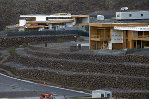
Upscale single family homes under construction in the Ascaya development, Henderson, Nevada: digital photograph
Date
2016-10-12
Archival Collection
Description
Construction work continues on upscale residential homes in the Ascaya development as seen from the City View Trail in Henderson.
Image