Search Results
Las Vegas, Nevada menus, approximately 1990 to 2019
Level of Description
Archival Collection
Collection Name: Michael Circuit Menu Collection
Box/Folder: Box 24, Box 25, Box 45, Box 46, Oversized Box 47, Oversized Box 48, Oversized Box 49, Oversized Box 50, Oversized Box 51, Oversized Box 52, Oversized Box 53, Oversized Box 54
Archival Component
Stephen Pierce at home, Las Vegas, Nevada: digital photograph
Date
Archival Collection
Description
Stephen Pierce poses in her Turnberry Place condo for the Southern Nevada Jewish Heritage Project.
Image

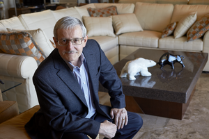
Bob and Lovee Arum, Las Vegas, Nevada: digital photograph
Date
Archival Collection
Description
Boxing promoter Bob Arum and his wife, Lovee, pose for portraits at the Top Rank offices for the Southern Nevada Jewish Heritage Project.
Image
Sunroc Masonry Products building in North Las Vegas, Nevada: digital photograph
Date
Archival Collection
Description
From the UNLV University Libraries Photographs of the Development of the Las Vegas Valley, Nevada (PH-00394). Part of the collection documents the entire 19 mile length of the north/south Eastern Avenue / Civic Center Drive alignment. This photograph was captured in the section of Civic Center Drive between Alexander Road and Cheyenne Avenue.
Image
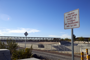
Signage at the Cheyenne Peaking Basin in North Las Vegas, Nevada: digital photograph
Date
Archival Collection
Description
From the UNLV University Libraries Photographs of the Development of the Las Vegas Valley, Nevada (PH-00394). Part of the collection documents the entire 19 mile length of the north/south Eastern Avenue / Civic Center Drive alignment. This photograph was captured in the section of Civic Center Drive between Alexander Road and Cheyenne Avenue.
Image
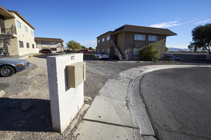
Apartments on Seco Adobe Circle in North Las Vegas, Nevada: digital photograph
Date
Archival Collection
Description
From the UNLV University Libraries Photographs of the Development of the Las Vegas Valley, Nevada (PH-00394). Part of the collection documents the entire 19 mile length of the north/south Eastern Avenue / Civic Center Drive alignment. This photograph was captured in the section of Civic Center Drive between Alexander Road and Cheyenne Avenue.
Image
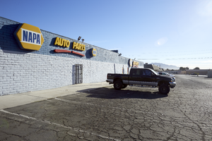
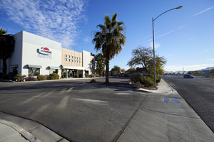
NAPA Auto Parts Store in North Las Vegas, Nevada: digital photograph
Date
Archival Collection
Description
From the UNLV University Libraries Photographs of the Development of the Las Vegas Valley, Nevada (PH-00394). Part of the collection documents the entire 19 mile length of the north/south Eastern Avenue / Civic Center Drive alignment. This photograph was captured in the section of Civic Center Drive between Alexander Road and Cheyenne Avenue.
Image
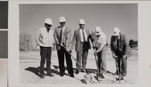
Photograph of the groundbreaking ceremony, University of Nevada, Las Vegas, circa 1991-1992
Date
Archival Collection
Description
Image
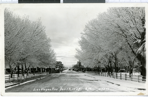
Postcard with photograph of Fremont Street, Las Vegas, Nevada, January 13, 1937
Date
Archival Collection
Description
Image

Postcard with photograph of Christ Episcopal Church, Las Vegas, Nevada, 1900-1930
Date
Archival Collection
Description
Image