Search the Special Collections and Archives Portal
Search Results
Vernon S. Caples oral history interview
Identifier
Abstract
Oral history interview with Vernon S. Caples conducted by Cheryl Caples on February 25, 1979 for the Ralph Roske Oral History Project on Early Las Vegas. Vernon S. Caples (born August 7th, 1891 in St. Johns, Oregon) discusses the history of Las Vegas, Nevada. Vernon describes what Las Vegas was like in the early days, from the Red Light District to the Nellis Air Force Base. He also mentions the implementation of a government program that was set in place to aid senior citizens living in Las Vegas.
Archival Collection
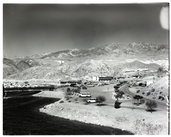
Film transparency of Willow Beach Marina, Arizona, 1972
Date
Archival Collection
Description
Image
Ed W. Clark Photograph Collection
Identifier
Abstract
The Ed W. Clark Photograph Collection contains photographs that depict politicians and businesspeople in Southern Nevada from 1900 to 1975. The photographs depict several Democratic Party members, including U.S. Senators Pat McCarran and Berkeley Bunker, Nevada Assemblyman Harry Edward "Hap" Hazard, and Nevada Governor Edward P. Carville. The photographs also depict political events, including the planting of a tree in the courthouse park of Las Vegas, Nevada, and a parade on Fremont Street in Las Vegas.
Archival Collection
C. D. Baker Photograph Collection
Identifier
Abstract
The C. D. Baker Photograph Collection depicts former Las Vegas, Nevada mayor Charles Duncan "C. D." Baker from 1916 to 1966. The photographs primarily depict Baker at political events, including campaign stops, fundraising events, meetings with officials and politicians, and at important locations in Las Vegas and Nevada. Baker was photographed with politicians such as U.S. Senator Chic Hecht, President Harry S. Truman, Governor Vail Pittman, and Lt. Governor Cliff Jones.
Archival Collection
C. D. Baker Engineering Field Notebooks
Identifier
Abstract
The C. D. Baker Engineering Field Notebooks are comprised of the notebooks and informational texts Charles Duncan "C. D." Baker created and used between 1909 and 1966 while he served as the County Surveyor for Clark County, Nevada and the City Engineer for Las Vegas, Nevada. The field notebooks contain survey coordinates and elevation data for much of early Las Vegas and provide important information on early property boundaries, historical elevations, and lengths of streets from the 1920s to the 1960s. There are also oversized right of way maps for Clark County, Nevada.
Archival Collection
Boulder City, Nevada scaled down subdivision plat maps: includes Villa Del Prado, Lake Terrace, Eagle's Nest, Lakeview Sites, Lake Mead Villas, Lewis Homes, La Dolce Vita, Mountain Vista, Marina Highland Estates, Casa Boulder, la Mancha, Panda Homes, Lake Mountain Estates, and Laketree, 1967 to 1979
Level of Description
Archival Collection
Collection Name: UNLV University Libraries Collection of Boulder City, Hoover Dam, and Lake Mead National Recreation Area Maps and Brochures
Box/Folder: Flat File 01 (MISSING), Flat File 02 (MISSING)
Archival Component
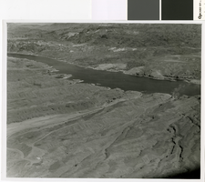
Photograph of Eldorado Canyon and Nelson's Landing after the September 1974 flood
Date
Archival Collection
Description
Eldorado Canyon and Nelson's Landing at the end of the cleanup after the 14 September 1974 Flood.
Image
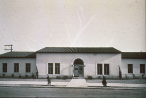
Slide of municipal building, Boulder City, Nevada, May 7, 1932
Date
Archival Collection
Description
Image
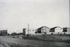
Slide of a tourist camp, Boulder City, Nevada, December 1, 1931
Date
Archival Collection
Description
Image

