Search Results
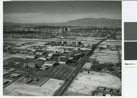
Aerial photograph of University of Nevada, Las Vegas, circa 1977
Date
Archival Collection
Description
Aerial view of UNLV. Also showing part of Las Vegas north of the university. Photograph follows Maryland Parkway north from about Tropicana Avenue. Both downtown Las Vegas and North Las Vegas can be seen in the distance.
Image
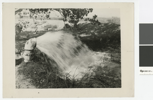
Photograph of artesian well throwing 60 inches of water, after 1950
Date
Archival Collection
Description
Man opening a valve to let an artesian well run
Transcribed Notes: Stamped on back: Vegas Studio, Las Vegas, Nevada; Handwritten inscription on back: Artesian well throwing 60 inches of water. Artesian wells average 400 ft. deep.
Image

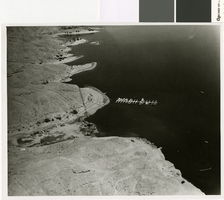
Aerial photograph of Black Canyon, Colorado River and Boulder City location before dam construction, 1920s
Date
Archival Collection
Description
Aerial view of Black Canyon, Colorado River, and Boulder City location before dam construction showing elevation.
Image
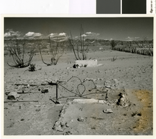
Photograph looking east through the remains of Saint Thomas, 1964
Date
Archival Collection
Description
Looking east through the remains of Saint Thomas from just south of Lord's Garage. Hannig's Ice Cream Parlor's remains are visible in the distance.
Image
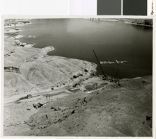
Photograph of flood damage recovery work on Nelson's Landing, September 1974
Date
Archival Collection
Description
Recovery operations at Nelson's Landing on the Colorado River after the 14 September 1974 Flood.
Transcribed Notes: Notes from photo sleeve: Nelson's Landing after the September 14, 1974 flood: salvage/recovery operations
Image
Photograph of flood damage recovery work on Nelson's Landing, circa September 1974
Date
Archival Collection
Description
Recovery operations at Nelson's Landing on the Colorado River after the 14 September 1974 Flood.
Transcribed Notes: Notes from photo sleeve: Nelson's Landing after the September 14, 1974 flood: salvage/recovery operations
Image
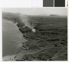
Aerial photograph of smoke from flood cleanup operations at Nelson's Landing, September 1974
Date
Archival Collection
Description
Smoke from three fires burning debris for cleanup operations after the 14 September 1974 flood at Nelson's Landing.
Image
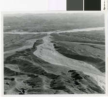
Aerial photograph of the flood path down Eldorado Canyon to Nelson's Landing, circa September, 1974
Date
Archival Collection
Description
Aerial view of the path of the flood down Eldorado Canyon to Nelson's Landing.
Image
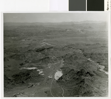
Aerial photograph of flood path, Eldorado Canyon to Nelson's Landing, September 14, 1974
Date
Archival Collection
Description
Aerial view of the path of the flood down Eldorado Canyon to Nelson's Landing.
Image
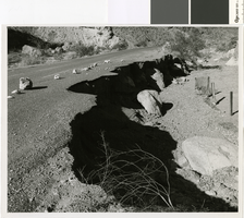
Photograph of damage to road above Eldorado Canyon from flood of September 14, 1974
Date
Archival Collection
Description
Road Damage on the Eldorado Canyon road from the September 1974 flood.
Image