Search the Special Collections and Archives Portal
Search Results
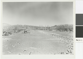
Photograph of Main Street after Lake Mead receded, Saint Thomas, Nevada, April 18, 1951
Date
Archival Collection
Description
Saint Thomas on the Muddy River, upper arm of Lake Mead, shows appearance of old Main Street after the lake had gone down, April 18, 1951. Lake Mead is in the background.
Image

Photograph of man and woman standing in front of building, St. Thomas, 1935-1938
Date
Archival Collection
Description
Lorraine and her father standing in front of the shell of a building, probably Hannig's Ice Cream Parlor, in antediluvian St. Thomas. Handwritten on bottom left corner: St. Thomas Nev.
Image
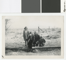
Photograph of four girls near outlet of artesian well, Pahrump, Nevada, before 1950
Date
Archival Collection
Description
Four children at the outlet of an artesian well.
Transcribed Notes: Handwritten on back: Our well. L-R: 1. ?, 2. Paula, 3. Dorothy, 4. Patsy
Image

Photograph of Rioville, Nevada, circa 1900
Date
Archival Collection
Description
Rioville, also known as Bonelli's Landing, Nevada.
Transcribed Notes: Notes on attached sheet: Rioville, Nevada (also known as Bonelli's Landing). It now lies at the bottom of Lake Mead, formed behind Hoover Dam. Rioville was founded by Daniel Bonelli, a Mormon pioneer sent by Brigham Young, about 1865 at the mouth of the Virgin River.
Image
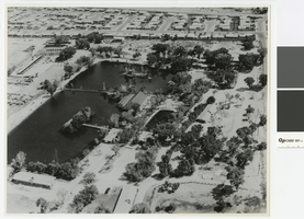
Aerial photograph of Lorenzi Park, 1965
Date
Archival Collection
Description
Aerial view of Lorenzi Park.
Transcribed Notes: 'Written on back of photo: Twin Lakes area - aerial photo; Notes on attached sheet: 1965. Ken Jones, photographer, must be credited.'
Image
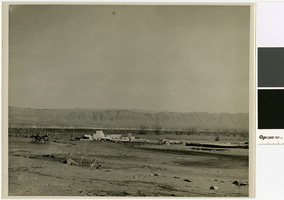
Photograph of the remains of a post office and Harry Gentry's Store in St. Thomas, 1945
Date
Archival Collection
Description
Remains of the post office and Gentry store with the receding water of Lake Mead in the background
Transcribed Notes: Transcribed from photo sleeve: "General view of resurrected town of St. Thomas. This photograph was shot looking toward Mormon Mesa. The lowered waters of Lake Mead can be seen in the middle of the photo."
Image
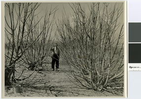
Photograph of a St. Thomas resident standing near dry hedges, 1945
Date
Archival Collection
Description
Hedges in St. Thomas
Transcribed Notes: Transcribed from photo sleeve: "Hedges planted by prosperous residents of St. Thomas. The trees in this photograph were under more than 50 feet of water for a period of about 7 years."
Image
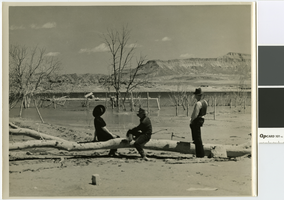
Photograph of the Perkins family sightseeing in St. Thomas, 1945
Date
Archival Collection
Description
The Perkins family sightseeing in St. Thomas
Transcribed Notes: Transcribed from photo sleeve: "Left to right, Mr. John F. Perkins' daughter, Mrs. Whitmore; his son Jack; and Mr. John F. Perkins, looking at the foundation of the former schoolhouse of St. Thomas. Both Jack and his sister went to school there."
Image
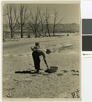
Photograph of a man inspecting the ruins of St. Thomas, 1945
Date
Archival Collection
Description
A man looking in a washtub in St. Thomas. The home referred to in the photograph belonged to Moses and Mary Gibson.
Transcribed Notes: Transcribed from photo sleeve: "A wash tub left to its fate in front of the former home of Moses Gibson, prominent farmer in St. Thomas before Lake Mead 'took over.' In the background can be seen the waters of Lake Mead."
Image
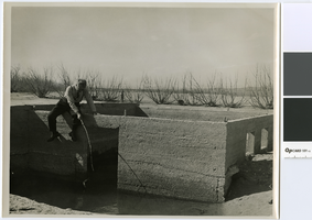
Photograph of a man fishing off the foundation of a house, St. Thomas, 1945
Date
Archival Collection
Description
A man fishing off the foundations of a house in St. Thomas
Transcribed Notes: Transcribed from photo sleeve: "As the waters of Lake Mead recede, a few fish were trapped in what used to be the basements of homes in St. Thomas."
Image
