Search Results
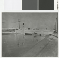
Photograph of the flooded Charleston Underpass, Las Vegas, before 1960
Date
Archival Collection
Description
Flooding in Las Vegas at the Charleston Underpass.
Image
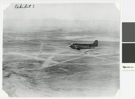
Aerial photograph of airplane and Las Vegas Airfield, Nevada, circa 1940
Date
Archival Collection
Description
Aerial view of an airplane and the Las Vegas Airstrip before the Army Air Corps took over the fields.
Image
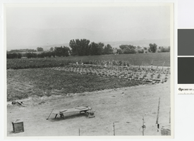
Photograph of Gilcrease Ranch, North Las Vegas, circa 1920's-1930's
Date
Archival Collection
Description
Field crops on the Gilcrease Ranch in North Las Vegas. Sheep Range in the background.
Image
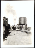
Photograph of train and water tank, March 7, 1920
Date
Archival Collection
Description
Water tank for locomotives located near round house. Steam visible from train.
Image
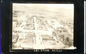
Aerial photograph of Las Vegas, westward direction, circa 1920
Date
Archival Collection
Description
Aerial view of Las Vegas
Image
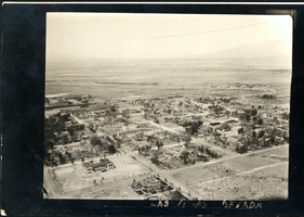
Aerial photograph of Las Vegas, northwest direction, circa 1920
Date
Archival Collection
Description
Aerial view of Las Vegas
Image
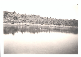
Photograph of irrigation pond at Wilson Ranch (Spring Mountain Ranch), 1921
Date
Archival Collection
Description
Indian school, irrigation pond on Wilson Ranch.
Image
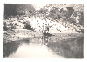
Photograph of irrigation pond at Wilson Ranch (Spring Mountain Ranch); September 1921
Date
Archival Collection
Description
Irrigation school at Wilson Ranch, 30 miles from Las Vegas.
Image
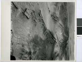
Aerial photograph of Frenchman Mountain looking southwest, May 4, 1949
Date
Archival Collection
Description
Aerial view of Frenchman Mountain, with the Las Vegas Valley behind it.
Transcribed Notes: Transcribed from handwritten notes on back: "View SW"
Image
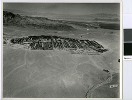
Aerial photograph of Boulder City, circa 1949
Date
Archival Collection
Description
Aerial view looking north of Boulder City.
Transcribed Notes: Transcribed from handwritten notes on back: "View N-ward"
Image