Search Results

Little Bow and Bryon, friends of Alice Key, performing "Got Act" for Count Basie: photographic print
Date
1930 (year approximate) to 1999 (year approximate)
Archival Collection
Description
From the Alice Key Photograph Collection (PH-00297)
Image
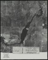
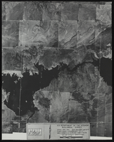
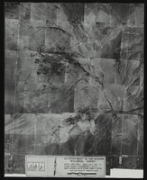
Aerial view of the Bonelli quadrant in Arizona-Nevada: photographic print
Date
1950
Archival Collection
Description
From the Army Mapping Service Aerial Photographs of Southern and Western Nevada (PH-00285). Aerial photographs, composites, and indices. Aerial photographs, Quad. Bonelli 4, U.S. Department of the Interior Geological Survey, Army Map Service. State: Arizona - Nevada. Flight Scale I-47200Project-GS-LJ. Index copied -8-26-50. Flying Comp. -7-26-50
Image
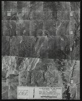
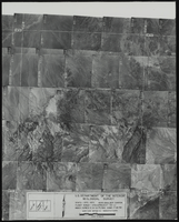
Aerial view of the Bonelli quadrant in Arizona-Nevada: photographic print
Date
1950
Archival Collection
Description
From the Army Mapping Service Aerial Photographs of Southern and Western Nevada (PH-00285). Aerial photographs, composites, and indices. High altitude aerial photographs, Quad. Bonelli, State: Arizona - Nevada. U.S. Geological Survey, Army Map Service. Flight Scale I-47200Project-GS-LJ. Index copied -8-26-50. Flying Comp. -7-26-50
Image
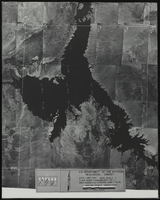
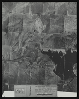
Aerial view of the Bonelli quadrant in Arizona-Nevada: photographic print
Date
1952
Archival Collection
Description
From the Army Mapping Service Aerial Photographs of Southern and Western Nevada (PH-00285). Aerial photographs, composites, and indices. High altitude aerial photographs, Quad. Bonelli 3, State: Arizona - Nevada. U.S. Geological Survey, Army Map Service. Flight Scale I-47200Project-GS-LJ. Index copied -8-26-50. Flying Comp. -7-26-50
Image
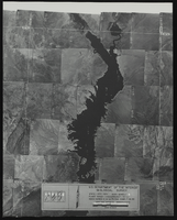
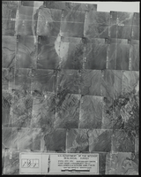
Aerial view of the Bonelli quadrant in Arizona-Nevada: photographic print
Date
1950
Archival Collection
Description
From the Army Mapping Service Aerial Photographs of Southern and Western Nevada (PH-00285). Aerial photographs, composites, and indices. High altitude aerial photographs, Quad. Bonelli, State: Arizona - Nevada. U.S. Geological Survey, Army Map Service. Flight Scale I-47200Project-GS-LJ. Index copied -8-26-50. Flying Comp. -7-26-50
Image
Aerial view of the Boulder Canyon quadrant in Arizona-Nevada: photographic print
Date
1950
Archival Collection
Description
From the Army Mapping Service Aerial Photographs of Southern and Western Nevada (PH-00285). Aerial photographs, composites, and indices. High altitude aerial photographs, Quad. Boulder Canyon 4, State: Arizona - Nevada. U.S. Geological Survey, Army Map Service. Flight Scale I-47200Project-GS-LJ. Index copied -8-26-50. Flying Comp. -7-26-50
Image
Aerial view of the Boulder Canyon quadrant in Arizona-Nevada: photographic print
Date
1950
Archival Collection
Description
From the Army Mapping Service Aerial Photographs of Southern and Western Nevada (PH-00285). Aerial photographs, composites, and indices. High altitude aerial photographs, Quad. Boulder Canyon, State: Arizona - Nevada. U.S. Geological Survey, Army Map Service. Flight Scale I-47200Project-GS-LJ. Index copied -8-26-50. Flying Comp. -7-26-50
Image
Aerial view of the Boulder Canyon quadrant in Arizona-Nevada: photographic print
Date
1950
Archival Collection
Description
From the Army Mapping Service Aerial Photographs of Southern and Western Nevada (PH-00285). Aerial photographs, composites, and indices. High altitude aerial photographs, Quad. Boulder Canyon 3, State: Arizona - Nevada. U.S. Geological Survey, Army Map Service. Flight Scale I-47200Project-GS-LJ. Index copied -8-26-50. Flying Comp. -7-26-50
Image
Aerial view of the Boulder Canyon quadrant in Arizona-Nevada: photographic print
Date
1950
Archival Collection
Description
From the Army Mapping Service Aerial Photographs of Southern and Western Nevada (PH-00285). Aerial photographs, composites, and indices. High altitude aerial photographs, Quad. Boulder Canyon, State: Arizona - Nevada. U.S. Geological Survey, Army Map Service. Flight Scale I-47200Project-GS-LJ. Index copied -8-26-50. Flying Comp. -7-26-50
Image
Aerial view of the Las Vegas quadrant in Arizona-Nevada: photographic print
Date
1950
Archival Collection
Description
From the Army Mapping Service Aerial Photographs of Southern and Western Nevada (PH-00285). Aerial photographs, composites, and indices. High altitude aerial photographs, Quad. Las Vegas 4. State: Arizona - Nevada. U.S. Geologial Survey, Army Map Service. Flight Scale I-47200Project-GS-LJ. Index copied -8-26-50. Flying Comp. -7-26-50
Image