Search Results
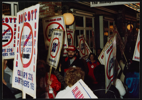
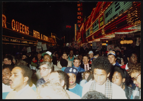
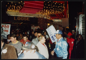
Jesse Jackson rally, Culinary Union, Las Vegas (Nev.), 1989 December (folder 1 of 6), image 16
Date
1989-12
Description
Arrangement note: Series I. Demonstrations, Subseries I.B. Other Demonstrations and Strikes
Image
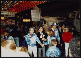
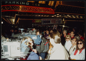
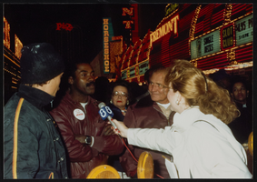
Jesse Jackson rally, Culinary Union, Las Vegas (Nev.), 1989 December (folder 1 of 6), image 17
Date
1989-12
Description
Arrangement note: Series I. Demonstrations, Subseries I.B. Other Demonstrations and Strikes
Image
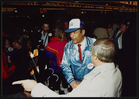
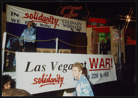
Jesse Jackson rally, Culinary Union, Las Vegas (Nev.), 1989 December (folder 1 of 6), image 18
Date
1989-12
Description
Arrangement note: Series I. Demonstrations, Subseries I.B. Other Demonstrations and Strikes
Image
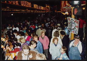
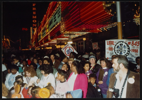
Jesse Jackson rally, Culinary Union, Las Vegas (Nev.), 1989 December (folder 1 of 6), image 19
Date
1989-12
Description
Arrangement note: Series I. Demonstrations, Subseries I.B. Other Demonstrations and Strikes
Image
Jesse Jackson rally, Culinary Union, Las Vegas (Nev.), 1989 December (folder 1 of 6), image 20
Date
1989-12
Description
Arrangement note: Series I. Demonstrations, Subseries I.B. Other Demonstrations and Strikes
Image
Jesse Jackson rally, Culinary Union, Las Vegas (Nev.), 1989 December (folder 1 of 6), image 21
Date
1989-12
Description
Arrangement note: Series I. Demonstrations, Subseries I.B. Other Demonstrations and Strikes
Image
Jesse Jackson rally, Culinary Union, Las Vegas (Nev.), 1989 December (folder 1 of 6), image 22
Date
1989-12
Description
Arrangement note: Series I. Demonstrations, Subseries I.B. Other Demonstrations and Strikes
Image
Jesse Jackson rally, Culinary Union, Las Vegas (Nev.), 1989 December (folder 1 of 6), image 23
Date
1989-12
Description
Arrangement note: Series I. Demonstrations, Subseries I.B. Other Demonstrations and Strikes
Image
Jesse Jackson rally, Culinary Union, Las Vegas (Nev.), 1989 December (folder 1 of 6), image 24
Date
1989-12
Description
Arrangement note: Series I. Demonstrations, Subseries I.B. Other Demonstrations and Strikes
Image
Jesse Jackson rally, Culinary Union, Las Vegas (Nev.), 1989 December (folder 1 of 6), image 25
Date
1989-12
Description
Arrangement note: Series I. Demonstrations, Subseries I.B. Other Demonstrations and Strikes
Image