Search Results

Geologic map and sections of area along Colorado River between Lake Mead and Davis Dam, Arizona and Nevada, 1963
Date
1963
Description
At top of map: 'United States, Department of Interior, Geological Survey. Professional Paper 374-E, plate 1.' In lower right corner of map: 'Geology mapped by C.R. Longwell.' Relief shown by contours. Includes seven colored cross-sections. Scale 1:125,000 (W 114°50´--W 114°20´/N 36°10´--N 35°10´). Series: Shorter contributions to general geology. Professional paper (Geological Survey (U.S.))374-E. Originally published as plate 1 in: Reconnaissance geology between Lake Mead and Davis Dam, Arizona-Nevada / by Chester R. Longwell, published by the U.S. Government Printing Office in 1963 in the series Shorter contributions to general geology and as Geological Survey professional paper 374-E.
Image
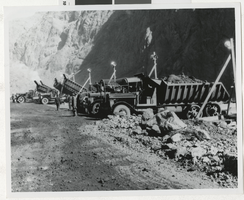
Photograph of dam workers and trucks, Hoover Dam, 1930s
Date
1930 to 1939
Archival Collection
Description
Dam workers and trucks during the construction of Hoover Dam, 1930s.
Image
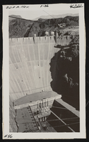
Photograph of dam, Hoover Dam (Nev.), January, 1936
Date
1936-01
Archival Collection
Description
Lower face of the Hoover Dam from Nevada, looking toward Arizona, Jan. 1936. Site Name: Hoover Dam (dam)
Image
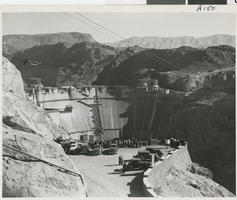
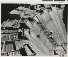
Photograph of dam construction, Hoover Dam, circa early 1930s
Date
1931 to 1936
Archival Collection
Description
Viewpoint of dam construction at Hoover Dam, Black Canyon.
Image
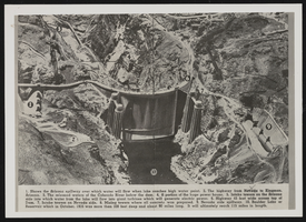
Photograph of view of Boulder Dam, Hoover Dam, December 4, 1939
Date
1939-12-04
Archival Collection
Description
Colorado River-Hoover Dam. Views of Boulder Dam printed in book or magazine; numbers on the photo correspond to particular areas described at the bottom of the image. Site Name: Hoover Dam (dam)
Image
Photograph of wall of dam, Hoover Dam, circa early 1930s
Date
1931 to 1936
Archival Collection
Description
Close up of forms for concrete and wall of dam at Black Canyon during Hoover Dam construction.
Image
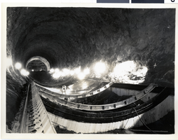
Photograph of dam construction, Hoover Dam, March 18, 1932
Date
1932-03-18
Archival Collection
Description
First 40 foot slab of concrete poured in lining diversion tunnels for the construction of the Boulder Dam, now called Hoover Dam. Site Name: Hoover Dam (dam)
Image
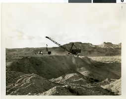
Photograph of dam construction, Hoover Dam, February 10, 1932
Date
1932-02-10
Archival Collection
Description
Construction site of the Boulder Dam, now known as Hoover Dam. Marion electric drag line with 5 cubic yard capacity bucket loading gravel. Site Name: Hoover Dam (dam)
Image
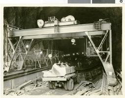
Photograph of dam construction, Hoover Dam, April 11, 1932
Date
1932-04-11
Archival Collection
Description
Boulder Dam (now called Hoover Dam) construction. Trucks hauling 2-cubic-yard buckets, bringing concrete from the mixing plant for invert lining. Site Name: Hoover Dam (dam)
Image