Search Results
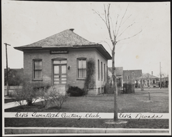
Exterior view of Elko Twentieth Century Club in Elko, Nevada: photographic print
Date
1900 (year approximate) to 1965 (year approximate)
Archival Collection
Description
From the Hazel Baker Denton Photograph Collection (PH-00312)
Image
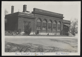
Exterior view of Reno Twentieth Century Club in Reno, Nevada: photographic print
Date
1900 (year approximate) to 1965 (year approximate)
Archival Collection
Description
From the Hazel Baker Denton Photograph Collection (PH-00312)
Image
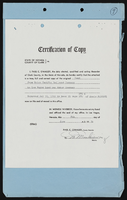
State of Nevada, County of Clark
Date
1954
Archival Collection
Description
State of Nevada, County of Clark
Text
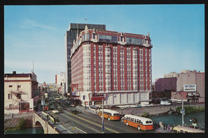
The Mapes Hotel in Reno, Nevada: postcard
Date
1940 (year approximate) to 1990 (year approximate)
Archival Collection
Description
From the Harvey's Hotel and Casino Postcard Collection (PH-00367) -- The Mapes Hotel in Reno, Nevada. One of Reno's luxurious hotels, the top floor of which is devoted to dining and dancing in the glass-enclosed Sky Room.
Image
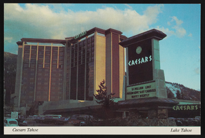
Caesars Tahoe in Stateline, Nevada: postcard
Date
1940 (year approximate) to 1990 (year approximate)
Archival Collection
Description
From the Harvey's Hotel and Casino Postcard Collection (PH-00367) -- Caesars Tahoe, a Caesars World Resort Casino/Hotel, Lake Tahoe, Nevada, situated amidst the beauty of Lake Tahoe and the splendor of the High Sierras.
Image
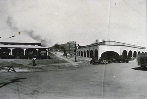
Slide of Nevada Highway, Boulder City, Nevada, December 1, 1931
Date
1931-12-01
Archival Collection
Description
Black and white image showing a view north of Birch Street, as seen from the Nevada Highway in Boulder City. The Six Companies, Inc. clubhouse, commissary and executives lodge are visible.
Image
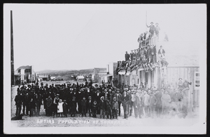
Entire population of Tonopah, Nevada in 1902: photographic print
Date
1902
Archival Collection
Description
Photograph of the entire population of Tonopah, Nevada in 1902.
Image
University of Nevada, Las Vegas (UNLV) 20th commencement program
Date
1983-05-22
Archival Collection
Description
Commencement program from University of Nevada, Las Vegas Commencement Programs and Graduation Lists (UA-00115).
Text
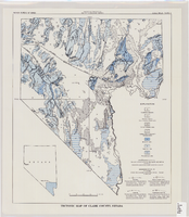
Tectonic map of Clark County, Nevada, 1965
Date
1965
Description
'Nevada Bureau of Mines. Bulletin 62, plate 5.' 'Prepared cooperatively by the U.S. Geological Survey.' Shows types of rocks as well as faults. Scale [ca. 1:760,320. 1 in. to approx. 12 miles] (W 116°--W 114°/N 37°--N 35°). Bulletin (Nevada Bureau of Mines)62.
Image
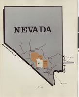
Map of Nevada Test Site: photographic print
Date
1945-19-82
Archival Collection
Description
Map of Nevada showing Nevada Test Site.
Image