Search Results
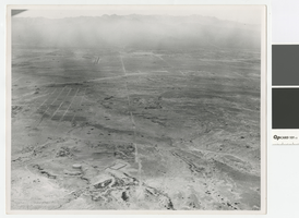
Aerial photograph of North Las Vegas looking west towards Mount Charleston, 1968
Date
Archival Collection
Description
Aerial view of North Las Vegas looking west with North Las Vegas Airport in the distance. The plane is directly over what is now I-15 and Cheyenne. In the foreground is a water tank where there are now many tanks.
Transcribed Notes: Handwritten on back: "Street Dept - Brooks, Cheyenne Area - 1968, looking west"
Image
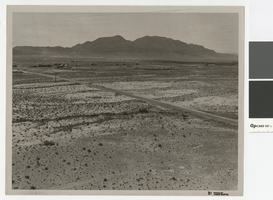
Photograph of Cheyenne Avenue looking east at Sunrise Mountain, June 5, 1973
Date
Archival Collection
Description
Cheyenne Avenue looking east at Sunrise Mountain.
Transcribed Notes: Handwritten on back: "Cheyenne looking east at sunrise. NLV - Streets & Roads - Photos" Stamped on back: "CNLV Engineering Dept."
Image
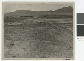
Aerial photograph over Cheyenne Avenue looking southeast, June 5, 1973
Date
Archival Collection
Description
Aerial view over Cheyenne Avenue looking southeast towards Frenchman Mountain
Transcribed Notes: Handwritten on back: "Over Cheyenne looking SE" Stamped on back: "CNLV Engineering Dept"
Image
Aerial photograph of Las Vegas Boulevard and Nellis Boulevard, June 5, 1973
Date
Archival Collection
Description
Aerial view of Las Vegas Blvd. and Nellis Blvd looking north.
Transcribed Notes: Handwritten on back: "LV Blvd & Nellis Blvd looking north" Stamped on back: CNLV Engineering Dept"
Image
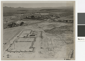
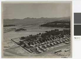
Aerial photograph of Las Vegas Blvd. and Cheyenne Ave., Las Vegas, June 5, 1973
Date
Archival Collection
Description
Aerial view of Las Vegas Blvd. and Cheyenne Avenue looking north.
Transcribed Notes: Transcribed from back of photo: "Building site of Safeway"
Image

Googie architectural design drawing of Brasilia Village, bird's-eye perspective, circa 1961
Date
Archival Collection
Description
Conceptual drawing of the proposed Brasilia Village hotel complex.
Address: Las Vegas; Clark County; Nevada
Image

Googie architectural design drawing of Riviera Villa (Las Vegas), bird's-eye view perspective, circa 1961
Date
Archival Collection
Description
Conceptual drawing of the proposed Brasilia Village, that was to be built on the NW corner of Tropicana and Las Vegas Boulevard in Las Vegas. 'A Boyd Ashcraft-Harry Whiteley development.'
Address: Las Vegas; Clark County; Nevada
Image
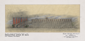
Googie architectural style design of studio apartment building (Las Vegas), exterior perspective, circa 1961
Date
Archival Collection
Description
Conceptual drawing of a proposed 20 unit studio apartment building for Investors Corporation of Nevada in Las Vegas.
Address: Las Vegas; Clark County; Nevada
Image

Googie architectural design drawing of Riviera Villa (Las Vegas), pool area perspective, circa 1961
Date
Archival Collection
Description
Pencil sketch of the pool area of the proposed Riviera Villa in Las Vegas.
Address: Las Vegas; Clark County; Nevada
Image
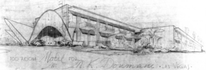
Googie architectural style design drawing of a 100-room motel (Las Vegas), exterior elevation, circa 1961
Date
Archival Collection
Description
Pencil sketch of the proposed Googie-style motel later called the Riviera Villa in Las Vegas.
Architecture and Design Style: GoogieImage