Search the Special Collections and Archives Portal

Search Results

Display    Results Per Page
Displaying results 481 - 490 of 491

Report on projected cost of water at Las Vegas for year 1930, February 4, 1930

Date

1930-02-04

Archival Collection

Description

Summary of the cost of water for the railroad and the water company in Las Vegas in 1930

Text

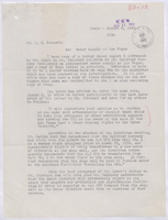
Letter from William Reinhardt (Los Angeles) to A. E. Stoddard, September 30, 1952

Date

1952-09-30

Archival Collection

Description

Discussion of strategy to resist the railroad being forced to spend money to increase water production; Letter has date stamps from E.E.B., E.C.R. and U.P. R.R. Law Department, Los Angeles. "80-12" is written in red pencil in top right corner.

Text

John Cannito oral history interview

Identifier

OH-03418

Abstract

Oral history interview with John Cannito conducted by Stefani Evans on April 03, 2018 for the Building Las Vegas Oral History Project. In this interview, Cannito discusses his early life and constantly moving to different states during his youth. He talks about his father’s employment with Amtrak, train transportation, and joining Perini Construction in Phoenix, Arizona. Cannito describes the role of an engineer in a construction company, and co-founding a software development company. Later, Cannito recalls joining The PENTA Building Group, the projects he was involved with, and becoming Chief Operating Officer. Lastly, Cannito discusses the company’s relationship with Native American-owned casinos, and the importance of maintaining long-term relationships with clients.

Archival Collection
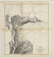
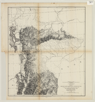
Maps of explorations and surveys for a railroad route from the Mississippi River to the Pacific Ocean, 1855

Date

1855

Description

Map no. 1. From the valley of Green River to the Great Salt Lake -- Map no. 2. From the Great Salt Lake to the Humboldt Mountains -- Map no. 3. From the Humboldt Mountains to the Mud Lakes -- Map no. 4. From the valley of the Mud Lakes to the Pacific Ocean. 'From explorations and surveys made under the direction of the Hon. Jefferson Davis, Secretary of War, by Capt. E.G. Beckwith, 3rd Artillery, E.G. Egloffstein, topographer for the route. 1855.' ''Selmar Siebert's Engraving & Printing Establishment, Washington, D.C.' Published by the War Dept. Scale 1:760,320. 12 miles to 1 in. Relief shown by hachures and spot heights.

Image

Letter from William Reinhardt (Omaha) to E. E. Bennett (Los Angeles), August 8, 1952

Date

1952-08-08

Archival Collection

Description

Discussion of the legality of Union Pacific Railroad Company continuing to supply water to the Pacific Fruit Express Company

Text
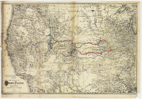
Map showing the Union Pacific Railway and connecting railroads, 1888

Date

1882

Description

Scale 1:3,800,000. 1 in. to 60 miles (W 126°--W 86°/N 48°--N 30°) ; 1 map : col. ; 57 x 85 cm ; Relief shown by hachures ; Prime meridian: Greenwich and Washington, D.C. ; "Entered according to act of Congress in the year 1882 by G.W. & C.B. Colton & Co. in the office of the Librarian of Congress, at Washington." ; Rufus Adams

Image

From the valley of Green River to the Great Salt Lake

Date

1855

Description

'From explorations and surveys made under the direction of the Hon. Jefferson Davis, Secretary of War, by Capt. E.G. Beckwith, 3rd Artillery, E.G. Egloffstein, topographer for the route. 1855.' ''Selmar Siebert's Engraving & Printing Establishment, Washington, D.C.' Published by the War Dept. Scale 1:760,320. 12 miles to 1 in. Relief shown by hachures and spot heights.

Image

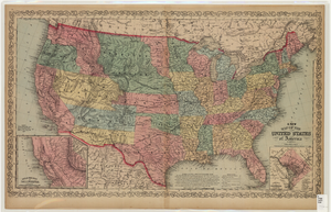
Map of the United States of America, 1859

Date

1859

Description

'Philadelphia. Published by Charles Desilver ... 1859.' Entered according to Act of Congress in the year 1856 by Charles Desilver in the Clerks office of the District Court of the Eastern District of Pennsylvania.' 'Engraved by J.L. Hazzard & E. Yeager.' Includes notes and insets titled 'Gold region of California' and 'District of Columbia.' Relief shown by hachures and spot heights. Also shows battle fields and proposed western railroad routes. Prime meridians: Washington and Greenwich. Atlas p. numbers in upper margin: 5-6. Scale 1:8,750,000 (W 126°--W 65°/N 48°--N 24°)

Image

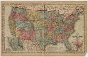
Map of the United States of America, 1856

Date

1856

Description

'Philadelphia. Published by Charles Desilver.' 'Entered according to Act of Congress in the year 1856 by Charles Desilver in the Clerks office of the District Court of the Eastern District of Pennsylvania.' 'Engraved by J.L. Hazzard & E. Yeager.' Includes notes and insets titled 'Gold region of California' and 'District of Columbia.' Relief shown by hachures and spot heights. Also shows battle fields and proposed western railroad routes. Prime meridians: Washington and Greenwich. Atlas p. numbers in upper margin: 5-6. Scale 1:8,750,000 (W 126°--W 65°/N 48°--N 24°).

Image

Newspaper clipping, Where I stand, Las Vegas Sun, May 9, 1953

Date

1953-05-09

Archival Collection

Description

Editorial from the Las Vegas Sun. Unlike a noble French merchant, who sacrificed greatly to give the people of Marseilles good water, the water company is trying to bleed all the money they can out of the situation before surrendering it to the water district. "80-11" written in red pencil. Date stamp from E.C.R.

Text