Search Results

Set of photographs including swimming team at Doolittle, Freddie Ray, and Mr. Keller: image 006
Date
Archival Collection
Image
Set of photographs including Elk Lodge celebration, Buds Auto advertisement, Mrs. Heat, St. James anniversary, Highland Library, Summer and Operation Head Start
Date
Archival Collection
Description
Photographer's notations: 10-18 Elks Celebrate "Night in Paris", 18-21 Buds Auto (Ad), Mrs. An Heat, 3-5 St. James Ann. '65, 2-5 Highland - Library, Summer and Operation Head Start '65.
Image
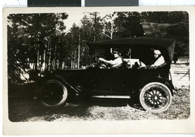
Black-and-white photograph of Wanda Moser at Mt. Charleston, Nevada, 1900-1930
Date
Archival Collection
Description
A picture of Wanda Ball Moser driving a Ford at Mt. Charleston.
Image

Black-and-white photograph of Emily Ball, Wanda Moser, and Eleanor Moser, Las Vegas, Nevada, 1910-1930
Date
Archival Collection
Description
From left to right: a picture of Emily Rebecca Ball (Wanda's mother), Wanda Ball Moser, and baby Eleanor Moser (Wanda's first child).
Image
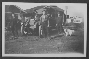
Photograph of Harold Stocker with Oscar Stocker, Los Angeles, circa 1900-1910
Date
Archival Collection
Description
Black and white photograph of Harold Stocker, Harry Newton, and Oscar Stocker in front of a Studebaker automobile in Los Angeles, California.
Image
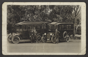
Black-and-white photograph of Oscar Stocker with his son Clarence Stocker, Los Angeles, circa 1905-1910
Date
Archival Collection
Description
Black and white photograph of Oscar Stocker standing by himself in front of a Jitney buss. Clarence Stocker is the man on the right in front of the second Jitney buss, and he was the driver in Los Angeles, California.
Image
Set of photographs including car wash, birthday party, Jean Murray and Sharn, Elder Ray, and Aunt Dott's welcome home
Date
Archival Collection
Description
Photographer's notations: 1-5 55 cent car wash, 6-13 Moore [or Mr. Dres?] Birthday Party, Sept. 65, 32-34 Jean Murray and Sharn, 15-20 Elder Ray, Aunt Dott's Welcome Home.
Image
Photographs of Frontier drug bust, Culinary Union, Las Vegas (Nev.), 1992 July 02 (folder 1 of 1)
Date
Archival Collection
Description
Arrangement note: Series I. Demonstrations, Subseries I.A. Frontier Strike
Image
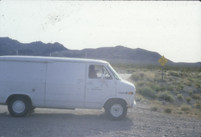
Department of Energy van in the desert during Lenten Desert Experience: photographic slide
Date
Archival Collection
Description
From the Sister Klaryta Antoszewska Photograph Collection (PH-00352). The side of the van says "Department of Energy".
Image