Search Results
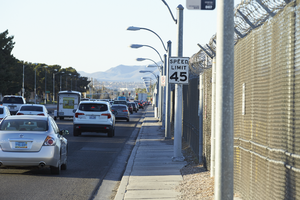
Traffic flows on Eastern Avenue next to the McCarran International Airport fence as seen from Eastern Avenue and Patrick Lane, looking south-southwest in Las Vegas, Nevada: digital photograph
Date
Archival Collection
Description
From the UNLV University Libraries Photographs of the Development of the Las Vegas Valley, Nevada (PH-00394). Part of the collection documents the entire 19 mile length of the north/south Eastern Avenue / Civic Center Drive alignment. This photograph was captured in the section of Eastern Avenue between Russell and Sunset Roads.
Image
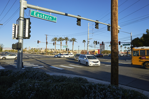
The intersection of Eastern Avenue and Patrick Lane, looking west-northwest in Las Vegas, Nevada: digital photograph
Date
Archival Collection
Description
From the UNLV University Libraries Photographs of the Development of the Las Vegas Valley, Nevada (PH-00394). Part of the collection documents the entire 19 mile length of the north/south Eastern Avenue / Civic Center Drive alignment. This photograph was captured in the section of Eastern Avenue between Russell and Sunset Roads.
Image
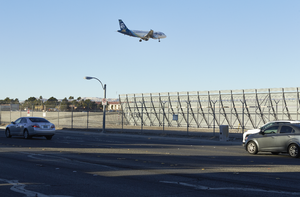
An airplane approaches McCarran International Airport over Eastern Avenue near Sunset Road, looking south-southwest in Las Vegas, Nevada: digital photograph
Date
Archival Collection
Description
From the UNLV University Libraries Photographs of the Development of the Las Vegas Valley, Nevada (PH-00394). Part of the collection documents the entire 19 mile length of the north/south Eastern Avenue / Civic Center Drive alignment. This photograph was captured in the section of Eastern Avenue between Russell and Sunset Roads.
Image
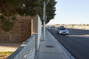
Cars travel past the Davis Funeral Home and Memorial Park on Eastern Avenue south of Patrick Lane, looking south in Las Vegas, Nevada: digital photograph
Date
Archival Collection
Description
From the UNLV University Libraries Photographs of the Development of the Las Vegas Valley, Nevada (PH-00394). Part of the collection documents the entire 19 mile length of the north/south Eastern Avenue / Civic Center Drive alignment. This photograph was captured in the section of Eastern Avenue between Russell and Sunset Roads.
Image
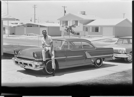
Set of photographs including Elders' ordination, Marion, Regina Tama, Dottie, and Clint: image 003
Date
Archival Collection
Image
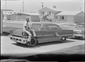
Set of photographs including Elders' ordination, Marion, Regina Tama, Dottie, and Clint: image 004
Date
Archival Collection
Image
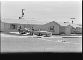
Set of photographs including Elders' ordination, Marion, Regina Tama, Dottie, and Clint: image 005
Date
Archival Collection
Image
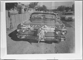
Set of photographs including Ernest Harris and Women's Progressive League: image 007
Date
Archival Collection
Image
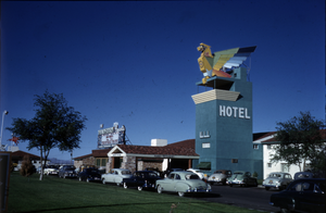
Color photograph of the Thunderbird Hotel, Las Vegas, circa 1940s
Date
Archival Collection
Description
Slide of the Thunderbird Hotel exterior and sign in the 1940s.
Image

Color photograph of the front of the Thunderbird Hotel, Las Vegas, circa 1940s
Date
Archival Collection
Description
The Thunderbird Hotel in Las Vegas, Nevada with an automobile parked out front.
Image