Search Results
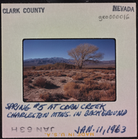
Photographic slide of spring at Corn Creek, Nevada, January 11, 1963
Date
Archival Collection
Description
Image
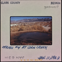
Photographic slide of spring at Corn Creek, Nevada, January 11, 1963
Date
Archival Collection
Description
Image
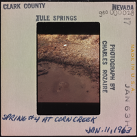
Photographic slide of a spring, Tule Springs, January 11, 1963
Date
Archival Collection
Description
Image
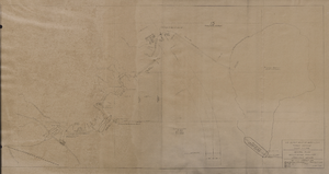
Map of general plan for the Wells Siding Project in Logandale, Nevada, May 15, 1935
Date
Archival Collection
Description
Image
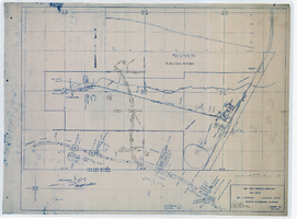
Map showing location of 24" C.I. pipeline in Las Vegas, Nevada, circa 1943
Date
Archival Collection
Description
Image
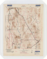
Topographic map of the Camp Mohave quadrangle in California, Nevada and Arizona, 1942
Date
Description
Image
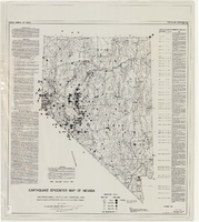
Earthquake epicenter map of Nevada, December 1964
Date
Description
Text

Plat map of El Rancho Village, Clark County, Nevada, July 28, 1942
Date
Description
Text

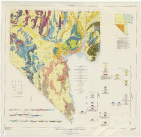
General geologic map of Las Vegas, Pahrump, and Indian Spring Valleys, Clark and Nye Counties, Nevada, 1948
Date
Description
At top of map: 'United States Department of the Interior, Geological Survey. State Engineer of Nevada. Water resources bulletin No. 5, Plate 1.' Relief shown by spot heights. Includes 3 inset maps of wells and springs in the vicinity of Pahrump, Manse Ranch and Indian Springs, Nevada. Scale [ca. 1:126,720. 1 inch to approx. 2 miles] (W 116°--W 115°/N 40°--N 36°). Originally published as plate 1 in Geology and water resources of Las Vegas, Pahrump, and Indian Spring Valleys, Clark and Nye Counties, Nevada by George B. Maxey and C.H. Jameson (1948), which is number 5 of the Water resources bulletin published by the Nevada Office of the State Engineer.
Image
Geologic map of Clark County, Nevada, 1964
Date
Description
62. Relief shown by contours and spot heights. Includes two index maps and eight cross-sections.
Image