Search Results
Photograph album 1, Leon Rockwell Collection, circa 1900s-1910s
Date
1900 to 1910
1905 to 1919
Archival Collection
Description
Photographs taken circa 1907-1914 in the Las Vegas, Nevada area, including Fort Callville, and during travels in California; Washington State; Idaho; Montana; and Oregon, with emphasis on Yosemite National Park and Yellowstone National Park. Album also features photographs taken at the 1911 Yakima (Washington) State Fair and in Salt Lake City, Utah, and Goodsprings, Nevada during the same period.
Image
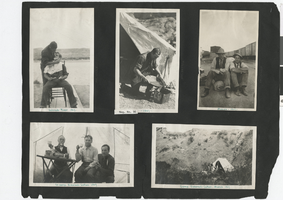
Photograph album 2, Ferron-Bracken Collection, circa 1905-1935, page 83
Date
1907
Description
Captions: "Colorado River 1907;" "1907;" Moapa 1907;" "In camp Eldorado Cañon 1907;" "Camp. Eldorado Cañon, March 1907."
Image
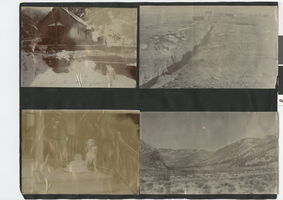
Photograph album 2, Ferron-Bracken Collection, circa 1905-1935, page 110
Date
1905 to 1935
Description
Photograph in upper left corner of this page captioned "Old school house at Bingham Ut 1900." Photograph in upper right corner captioned "Asphaltene mine, Fort Duschene, Ut." Photograph in lower right corner captioned "Utah valley."
Image
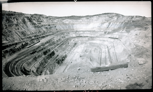
Film transparency of an open-pit copper mine, Ruth, Nevada, August, 1937
Date
1937-08
Archival Collection
Description
An open-pit copper mine located in Ruth, Nevada. Surface mining is done by removing (stripping) surface vegetation, dirt, and, if necessary, layers of bedrock in order to reach buried ore deposits. Techniques of surface mining include: open-pit mining, which is the recovery of materials from an open pit in the ground, quarrying, identical to open-pit mining except that it refers to sand, stone and clay; strip mining, which consists of stripping surface layers off to reveal ore/seams underneath; and mountaintop removal, commonly associated with coal mining, which involves taking the top of a mountain off to reach ore deposits at depth. Most (but not all) placer deposits, because of their shallowly buried nature, are mined by surface methods. Finally, landfill mining involves sites where landfills are excavated and processed.
Image
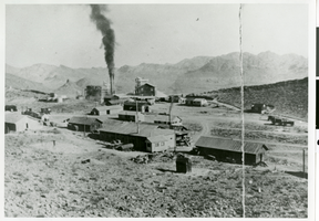
Photograph of West End Chemical Mine, 1925
Date
1925
Archival Collection
Description
West End Chemical Mine, 1925.
Image
Photograph of mining in Arizona, circa 1930s
Date
1930 to 1939
Archival Collection
Description
Mining in Arizona.
Image

Slide of a gold mining sign, Virginia City, Nevada, circa 1960s
Date
1960 to 1969
Archival Collection
Description
A picture of a "Chicago Nevada Gold Mining Co" sign near Virginia City.
Image

Slide of a gold mine, Virginia City, Nevada, circa 1960s
Date
1960 to 1969
Archival Collection
Description
A picture of a gold mining building near Virginia City.
Image
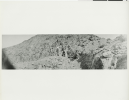
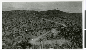
Photograph of men mining in the Bare Mountain Range, Nevada, circa early 1900s
Date
1900 to 1920
Archival Collection
Description
Men gather around mining equipment in the Bare Mountain Range in Nevada.
Image
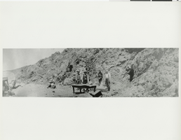
Photograph of men in the desert, Chloride, Arizona, circa 1910
Date
1910
Archival Collection
Description
Men gather around a table in the mountains in Chloride, Arizona.
Image