Search Results

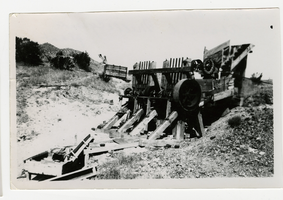
Photograph of a man working outside the Dividend Mining Company mill, Tonopah Dividend Mine (Nev.), 1916
Date
1916
Archival Collection
Description
Inscription on back reads: "This picture shows the head of our 2V-HP engine which operated the mill and compressor"
Image
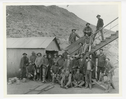
Photograph of mine workers at the Indian Mine, Round Mountain (Nev.), 1900-1925
Archival Collection
Description
Group of men pose at the Indian Mine
Image

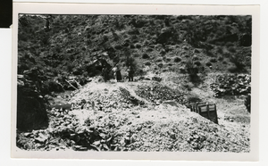
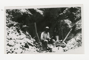
Photograph of two men with an ore cart standing at a mine adit, 1900-1925
Date
1900 to 1925
Archival Collection
Description
Photograph of two men with an ore cart standing at a mine adit, 1900-1925
Image
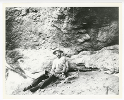
Photograph of O. K. Reed and his son Little O. K. near his claim at Gold Reed, Tonopah (Nev.), 1920
Date
1920
Archival Collection
Description
Photograph of O. K. Reed and his son Little O. K. near his claim at Gold Reed, Tonopah (Nev.), 1920
Image

Photograph of the Cinnabar mine at Ned's Cache Spring, Goldfield (Nev.), 1920
Date
1920
Archival Collection
Description
Photograph of the Cinnabar mine at Ned's Cache Spring, Goldfield (Nev.), 1920
Image
Photograph of the Tonopah Extension Mine Shaft No. 1, Tonopah (Nev.), 1908
Date
1908
Archival Collection
Description
Photograph of the Tonopah Extension Mine Shaft No. 1, Tonopah (Nev.), 1908
Image
Photograph of the View of Virginia Mine shaft, Searchlight (Nev.), 1907
Date
1907
Archival Collection
Description
Possibly Clyde & Blanch Jackson in background
Image
Photograph of Clyde Jackson seated above a mine shaft with the mine owner, Searchlight (Nev.), 1907
Date
1907
Archival Collection
Description
Clyde Jackson on right
Image
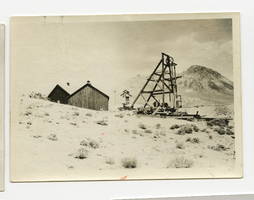
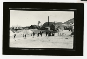
Photograph of the headframe and buidlings at the Revert Divide Mine, 1900
Date
1900
Archival Collection
Description
Photograph of the headframe and buidlings at the Revert Divide Mine, 1900
Image
Photograph of an abandoned mill and cyanide plant, Goldfield (Nev.), 1900
Date
1900
Archival Collection
Description
Divide mining district
Image