Search Results
Las Vegas Paiute Colony real estate appraisal report
Date
Archival Collection
Description
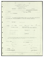
Fair market value appraisal, including area maps, of Las Vegas Paiute Colony land at $24,000.
Text
Joint Use Agreement with Rocky Mountain Produce Company to provide access to the Las Vegas Paiute Colony
Date
Archival Collection
Description
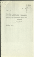
Joint Use Agreement signed by Rocky Mountain Produce Company providing for recognized road access to the Las Vegas Indian (Paiute) Colony. Includes a map and related Bureau of Indian Affairs correspondence.
Text
Request for transfer of excess government real property for use by the Las Vegas Paiute Colony: correspondence
Date
Archival Collection
Description
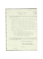
Notice of Public Hearing by the Board of Zoning Adjustment. Letter from Superintendent Robert L. Hunter to Area Director John Artichoker about acquiring excess GSA administered land for use by the Las Vegas Indian (Paiute) Colony. Request for transfer of excess real property and related personal property General Services Administration form and statement of justification. Letter from Assistant Area GSA Director Charles D. Worthman to A. B. Pace about the request form for transfer of property. Memorandum to Area Directors about attempts to acquire land on behalf of Native American tribes. Letter from Superintendent to Area Director John Artichoker about the derailment of a Union Pacific Railroad car adjacent to the Las Vegas Paiute Indian Colony. Letter from Las Vegas Paiute Tribal Council Chairman Kenneth D. Anderson to Union Pacific Railroad about specifications for a fence. Letter from Nevada Indian Legal Services Staff Attorney Frederick B. Stocking to Ray Jackson, Bureau of Indian Affairs Phoenix Area Office, about the Las Vegas Indian (Paiute) Colony's attempt to acquire GSA-administered land. Letter from Robert Donlevy, Area Realty Officer, to Frederick B. Stocking reporting progress on acquiring government surplus land. Memorandum from Area Realty Officer to Superintendent, Western Nevada Agency, about request for transfer of surplus land. Letter from A. B. Pace to Assistant Area Director Charles Worthman stating why request for land was denied. Notice of availability of excess real property from Director of Real Property Division A. B. Pace. Description of excess real property and map showing its location in the Las Vegas region.
Text
Las Vegas Paiute Colony improvement and relocation proposal records
Date
Archival Collection
Description
Resolution of the Adult Members of the Las Vegas Indian Colony granting utility companies access to the community to construct electrical infrastructure. Report from Realty Officer Ned Mitchell regarding a community relocation meeting, with attendees documented. Data sheet about the Las Vegas Paiute Colony. Letter from Area Director F. M. Haverland to the Bureau of Indian Affairs commissioner regarding increased lot sizes. A newspaper clipping is attached, "U.S. Aid to Be Sought For Indian Colony Here."
Text
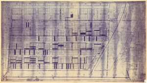
Plat of original townsite of Las Vegas, Clark County, Nevada, November 25, 1927
Date
Description
Subtitle: 'On N 1/2 of SW 1/4 section 27, T 20 S, R 61 E, M.D. Mer. showing cast iron water mains. Including location and distances of valves, fire hydrants, house connections, etc. Constructed by Las Vegas Land &Water Company. Construction completed Nov. 25-1927. Cast iron pipe system throughout made at Provo, Utah by Pacific States Cast Iron Pipe Company. R.N. Clark, Construction Engineer. Map and survey made by J.T. McWilliams, C.E., Las Vegas, Nev.' Map shows ownership of some parcels of land. Scale [ca. 1:960]. 1 inch to 80 feet. Blueline print. Plat map.
Image

Plat showing original townsite and subdivisions, Las Vegas, Lincoln County, Nevada, May 1905
Date
Description
Land owned by the San Pedro, Los Angeles & Salt Lake Railroad is outlined. Scale: [ca. 1:12,000]. 1 inch = 1,000 feet. Cadastral map. Blueline print. Additional copy available in the J.T. McWilliams manuscript collection
Image

Original plat, townsite of Las Vegas, Lincoln Co., Nevada, January 13, 1905
Date
Description
Subtitle: 'Embracing the N. 1/2 of S.W. 1/4 Sec. 27 Township 20S. R.61E. Mt. Diablo Meridian.' 'Book 1, page 17A" handwritten in lower right corner. Signed by Henry Lee, County Recorder, Lincoln County Nevada. 'Filed at request of J.T. Williams, January 13th A.D. 1905.' Backwards handwriting on right side. Map has a Lincoln County seal on the bottom near the center. In the dedication J.T. McWilliams states that he has surveyed and platted the townsite of Las Vegas subject to the right of way of the San Pedro, Los Angeles and Salt Lake Railroad Company. He signed the dedication on Jan. 13, 1905, and it was signed by witnesses Scale [ca. 1:2,520? 1 inch to approx. 210 feet?]. Copy of a blueline print.
Image
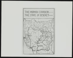
The Mormon Corridor: map
Date
Archival Collection
Description
Image
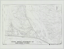
Coyote Springs Investments, LLC Golf Course Location: map
Date
Archival Collection
Description
From the Jeff Van Ee Papers (MS-00470) -- Coyote Springs development -- Maps file.
Image
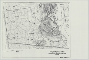
Coyote Springs Valley Street Layout & Waters of the United States Crossings: map
Date
Archival Collection
Description
From the Jeff Van Ee Papers (MS-00470) -- Coyote Springs development -- Maps file.
Image