Search Results
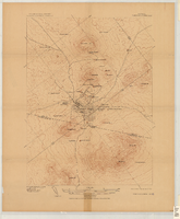
Map of Tonopah Mining District, Nevada, circa 1905
Date
1900 to 1910
Description
Scale [ca.1:12,804. 1 in. to approx. 1,067 ft.] ; 1 map ; on sheet 92 x 106 cm ; Relief shown by hachures ; Title supplied by cataloger ; Probably a preliminary black and white edition of the colored map copyrighted by Bradford and Bradford in 1905 Bradford and Bradford.
Image

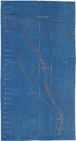
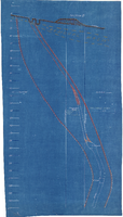
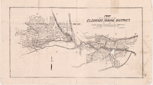
Cross-section maps of Combination and Florence Mines, Goldfield, Nevada, circa 1902-1908
Date
1902 to 1908
Description
Maps of Combination and Florence Mines, Goldfield, Nevada.
Image
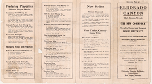

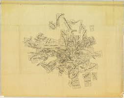
Map of underground workings in Potosi and Central Lodes, May 1906
Date
1906-05
Description
'Scale 20 ft = 1 in.'
Image
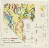
Geologic map of Clark County, Nevada, 1964
Date
1964
Description
'By C.R. Longwell, E.H. Pampeyan, and Ben Bowyer.' 'Prepared cooperatively by the U.S. Geological Survey.' 'Topographic base from Army Map Service Kingman (1947) and Las Vegas (1953) two-degree quadrangle. More recent editions were published after geological compilation and are used on Plate 2.' 'Geology compiled 1955 with revisions and additons to 1964.' At top of map: 'Nevada Bureau of Mines. Bulletin 62, Plate 1.' Published by Williams & Heintz Map Corp. Scale 1:250,000. Bulletin (Nevada Bureau of Mines)62. Relief shown by contours and spot heights. Includes two index maps and eight cross-sections.
Image