Search the Special Collections and Archives Portal
Search Results
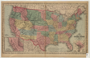
Map of the United States of America, 1859
Date
1859
Description
'Philadelphia. Published by Charles Desilver ... 1859.' Entered according to Act of Congress in the year 1856 by Charles Desilver in the Clerks office of the District Court of the Eastern District of Pennsylvania.' 'Engraved by J.L. Hazzard & E. Yeager.' Includes notes and insets titled 'Gold region of California' and 'District of Columbia.' Relief shown by hachures and spot heights. Also shows battle fields and proposed western railroad routes. Prime meridians: Washington and Greenwich. Atlas p. numbers in upper margin: 5-6. Scale 1:8,750,000 (W 126°--W 65°/N 48°--N 24°)
Image
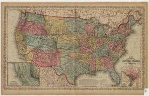
Map of the United States of America, 1856
Date
1856
Description
'Philadelphia. Published by Charles Desilver.' 'Entered according to Act of Congress in the year 1856 by Charles Desilver in the Clerks office of the District Court of the Eastern District of Pennsylvania.' 'Engraved by J.L. Hazzard & E. Yeager.' Includes notes and insets titled 'Gold region of California' and 'District of Columbia.' Relief shown by hachures and spot heights. Also shows battle fields and proposed western railroad routes. Prime meridians: Washington and Greenwich. Atlas p. numbers in upper margin: 5-6. Scale 1:8,750,000 (W 126°--W 65°/N 48°--N 24°).
Image
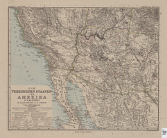
Map of Southwestern United States of America, 1888
Date
1888
Description
33 x 41 cm. Relief shown by hachures and spot heights. 1 sheet of a 6-sheet map. "Petermann: ver. st. v. am. bi. 4". "Stieler's Hand Atlas, No. 86." Binder's title of Hand Atlas über alle Thiele der Erde und über das Weltgebäude, which was published in 1879. In German. Revised 1889. "Neubearbeitret v. H. Habenicht." Original publisher: Justus Perthes, Scale: 1:3,700,000.
Image
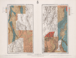
Maps of geographical surveys of parts of California, southeastern Nevada, Arizona and southwestern Utah, made under the command of George M. Wheeler, 1872-1873
Date
1872 to 1873
Description
At top of plate: 'U.S. geographical surveys west of the one-hundredth meridian. Parts of California, S.E. Nevada, Arizona & S.W. Utah.' At bottom of plate: 'Expeditions of 1872 & 1873, under the command of 1st Lieut. Geo. M. Wheeler, Corps of Engineers, U.S. Army.' 'G. K. Gilbert, A. R. Marvine, E. E. Howell, geological assistants.' 'By order of The Honorable The Secretary of War, under the direction of Brig. Gen. A. A. Humphries, Chief of Engineers, U.S. Army.' Published by Government Printing Office. 2 map sections on 1 sheet. Scale: 1 inch to 8 miles.
Image
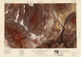
Satellite image map of the Las Vegas Valley, 1981
Date
1981
Description
'1981. Experimental edition 36114-A1-SI-250.' Scale 1:250,000 ; Transverse Mercator proj. (W 116°--W 114°/N 37°--N 36°). Series: Western United States 1:250,000. Western United States 1:250,000 ; NJ 11-12. Filing title: Las Vegas, Nev.; Ariz.; Calif. 'Imagery recorded with Multispectral Scanner (MSS) on NASA Landsat-3.' Includes image coverage diagram. Separate map on verso: Las Vegas / prepared by the U.S. Army Topographic Command ; revised by the U.S. Geological Survey 1969. Ed. 5. Washington, D.C. : Geological Survey, 1976, NJ 11-12 in the series Western United States 1:250,000. United States Geological Survey
Image
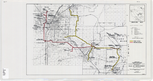
Map showing second stage plan of development for Southern Nevada Water Project, March 1981
Date
1981-03
Description
'United States Department of the Interior, Bureau of Reclamation.' 'June 1976. Revised March 1981.' 'Map No. 952-300-203.' 'Exhibit I.' Includes inset location map for project area. Scale [ca. 1:126,720. 1 in. to approx. 2 miles] . United States Department of the Interior, Bureau of Reclamation
Image
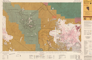
Map of Las Vegas, Nevada and surrounding Bureau of Land Management areas to the west and north, 1994
Date
1994
Description
'BLM edition, 1994.' 'Surface management status; mineral management status.' '1:100,000-scale topographic map showing highways, roads and other manmade structures; water features; contours and elevations in meters with conversions to feet; BLM recreation sites.' 'Edited and published by the Bureau of Land Management. Base map prepared by the U.S. Geological Survey.' I53:11/4-2
Text
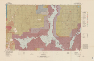
Topographic map of Lake Mead quadrangle, Nevada and Arizona, 1979
Date
1979
Description
'Edited and published by the Bureau of Land Management. Base map prepared by the U.S. Geological Survey.' 'Surface management status by BLM, 1981.Minerals management status by BLM, 1981.' Relief shown by contours and spot heights. Contour interval 50 meters. Compiled from USGS maps dated 1952-1970. Revised from aerial photographs taken 1972-73. Map edited 1979. Includes location map and index to 1:24,000 and 1:62,500-scale maps. Shows minerals owned by the federal government. 'N3600--W11400/30x60.' 'SE/4 Las Vegas (NJ 11-12) 1:250,000-scale map.' Scale 1:100,000
universal transverse Mercator proj. (W 115°00'--W 114°00'/N 36°30'--N 36°00'). Series: Surface-minerals management status. United States. Bureau of Land Management. Surface-minerals management status. Filing title: Lake Mead, Nev.--Ariz., 1979. Shows township and range lines. Published by United States, Dept. of the Interior, Bureau of Land Management
Denver, Colo. : For sale by U.S. Geological Survey,
Image
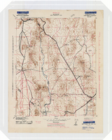
Topographic map of the Camp Mohave quadrangle in California, Nevada and Arizona, 1942
Date
1942
Description
Scale 1;250,000 ; polyconic projection (W 115°--W 114V/N 36V--N 35V) ; 1 map : col. ; 52 x 37 cm ; Relief shown by contours and spot heights. Contour interval 250 feet ; "Training map"--Center of upper margin of map ; "Base compiled from U.S. Geological Survey quadrangles. Control from U.S. Geological Survey. Revised from state highway maps for Arizona, Nevada and California" ; "Culture revisions shown in red based on reconnaissance by 67th Engr. Co. (Top.). May not be of same accuracy as base map." ; Map shows roads, trails, ponton sites, dam sites, possible air fields, possible landing fields, airports, water points, and impassable areas ; Map was originally restricted. "Classification cancelled by authority of Chief of Engineers letter of Jan. 22, 1946." ; Title at top of map: Nevada-Arizona-California : Camp Mohave quadrangle : grid zone F ; Army Map Service, U.S. Army.
Image
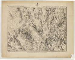
Map showing parts of eastern and southeastern Nevada and southwestern Utah, circa 1873
Date
1869
1872 to 1873
Archival Collection
Description
Scale 1:506,880. 1 in. to 8 miles (W 117°30--W 114°45/N 37°20--N 40°00). Relief shown by hachures and spot heights. At top left: 'Explorations & surveys west of the one-hundredth meridian.' At top right: 'Parts of Eastern & Southeastern Nevada & Southwestern Utah. Atlas sheet number 66.' At bottom left: 'Expeditions of 1869, 1872 & 1873.' At bottom right: ' 1st Lieut. Geo. M. Wheeler, Corps of Engineers, com'd'g.' Seal of the War Department, Corps of Engineers, U.S. Army at top center of map. Originally published as part of the geological atlas which is an appendix to the Survey's Report upon United States geographical surveys west of the one hundredth meridian, published in 1876?
Image
Pagination
Refine my results
Content Type
Creator or Contributor
Subject
Archival Collection
Digital Project
Resource Type
Year
Material Type
Place
Language
