Search Results
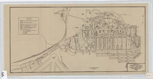
Cadastral map of Boulder City, Nevada, 1940
Date
1905-04-23
Description
A. M. S. Jan. 1940 in the lower left-hand corner. 1 map ; 61 x 30 cm. Cadastral map. "No. 40-1" in the lower right-hand corner. Shows block and lot numbers, buildings, water supply and sewage system, leased areas.
Image
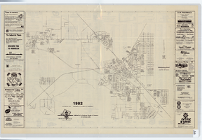
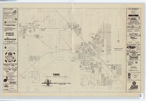
Street map of Henderson, Nevada, 1982
Date
1982
Description
53 x 68 cm. "Industrial center of Nevada, gateway to Lake Mead." Includes advertisements. Index, advertisements, and inset map of Las Vegas area on verso. "Copyright 1981." Original publisher: Chamber of Commerce (Henderson, Nev.). Original publisher: Chamber of Commerce (Henderson, Nev.)
Image

Street map of Las Vegas, 1966
Date
1966
Description
1966 ed. Color; 56 x 43 cm., folded to 23 x 10 cm. Panel title: Street map of Las Vegas and vicinity. On bottom of panel: Humble Oil & Refining Company. Index, photographs of Las Vegas scenes and nearby tourist attractions and map titled Lake Mead National Recreation Area, lower basin section on verso. Original publisher: H. M. Gousha Company.
Image


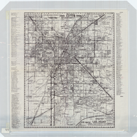
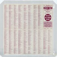
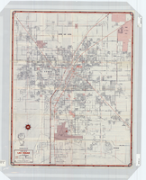
Street map of greater Las Vegas, Nevada, 1965-1966
Date
1965 to 1966
Description
Rev. 1965-1966 ed. 55 x 42 cm., folded to 29 x 12 cm. Panel title: Front Boy's official street map. Relief shown by spot heights. Copyright held by Russell A. Meador. Includes notes, quotations and indexes. Street index on verso. "Detailed guide of North Las Vegas, Las Vegas, Paradise Valley, and vicinity." Original publisher: Meador, Russell A.
Image