Search Results
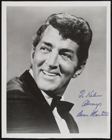
Dean Martin, actor: photographic print
Date
1950 to 1964
Archival Collection
Description
Photo (promo) of Dean Martin, autographed for Helen Shepp.
Image
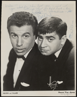
Bobby Nelson and Artie Palmer, entertainers: photographic print
Date
1950 to 1964
Archival Collection
Description
Promotional photo of Bobby Nelson (left) and Artie Palmer, entertainers. It was Autographed for Helen.
Image
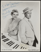
Lee and Faye Maynard, entertainers: photographic print
Date
1950 to 1964
Archival Collection
Description
Autographed promo photo of entertainers Lee and Faye Maynard.
Image
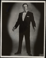
Frank Sorello, actor: photographic print
Date
1950 to 1964
Archival Collection
Description
Entertainer Frank Sorello. Promotional photo autographed for Helen Shepp.
Image
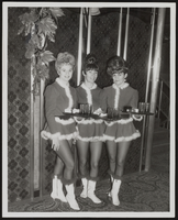
Unidentified cocktail waitresses: photographic print
Date
1950 to 1964
Archival Collection
Description
Cocktail waitresses, Las Vegas, in Christmas costumes. (n.d.)
Image

Unspecified show in Las Vegas: photographic print
Date
1950 to 1964
Archival Collection
Description
Las Vegas show. (not identified) (n.d)
Image
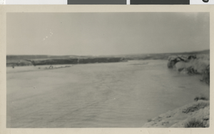
Photograph of Arizona side looking towards Callvilles, Nevada-Arizona border, 1929
Date
1929
Archival Collection
Description
Black and white image of the view from the Arizona side looking toward Callvilles (out of view, but in the grove of cottonwoods in the distance). It must be remembered that in those days the river was mostly silt, sand and during flood times huge rocks. Government engineers estimated that the Colorado River carried to the Gulf of California 94,000,000 tons of silt and rocks every 24 hours.
Image
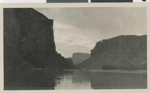
Photograph of Black Canyon, 1929
Date
1929
Archival Collection
Description
Black and white image of Black Canyon, where Hoover Dam now is. Sharp hill showing in the background is Fortification Mountain on Arizona side of the river. Fortification is now about halfway covered by the waters of Lake Mead.
Image
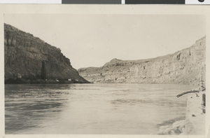
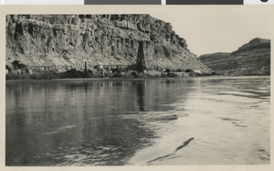
Photograph of Colorado river, Boulder Canyon, August 1929
Date
1929-08
Archival Collection
Description
The Colorado River, Boulder Canyon looking upstream from a boat in late August 1929. Drill rig on the Nevada side of the Colorado River can be seen on the left of the photo.
Image
Photograph of Colorado River, Boulder Canyon, August 1929
Date
1929-08
Archival Collection
Description
Black and white photograph of Colorado River, Boulder Canyon in early August 1929. Close up of the first core drill rig on Nevada side of the Colorado River where the dam was first planned. Picture was taken from boat on the river.
Image