Copyright & Fair-use Agreement
UNLV Special Collections provides copies of materials to facilitate private study, scholarship, or research. Material not in the public domain may be used according to fair use of copyrighted materials as defined by copyright law. Please cite us.
Please note that UNLV may not own the copyright to these materials and cannot provide permission to publish or distribute materials when UNLV is not the copyright holder. The user is solely responsible for determining the copyright status of materials and obtaining permission to use material from the copyright holder and for determining whether any permissions relating to any other rights are necessary for the intended use, and for obtaining all required permissions beyond that allowed by fair use.
Read more about our reproduction and use policy.
I agree.Information
Digital ID
Permalink
Details
Member of
More Info
Rights
Digital Provenance
Publisher
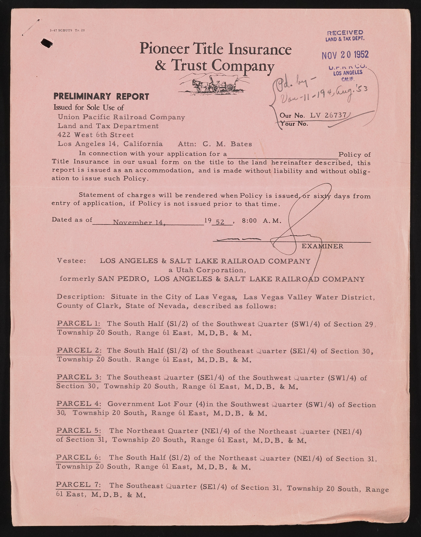
Transcription
3-47 SCBUT9 T r . 20 RECEIVED LAND & tax OtK. & Trust Company K a#* turtflCC \ NOV 2 0 1952 PRELIMINARY REPORT Issued fo r Sole U se o f Union. P a c ific R a ilroa d Land and T ax D epartm e 422 W est 6th S treet L os A n geles 14, C a liforn ia Attn: C. M. B ates In connection with your application for a P olicy of Title Insurance in our usual form on the title to the land hereinafter described, this report is issued as an accom m odation, and is made without liability and without ob ligation to issue such P olicy. Statement of charges w ill be rende entry of application, if P olicy is not issue Y e ste e : LOS ANGELES & SA LT L.A a Utah Cc fo r m e r ly SAN PE D R O , LOS ANGELI D escrip tion : Situate in the C ity of L as V egas, L as V egas V alley W ater D is tr ic t, County of C la rk , State of N evada, d e s crib e d as fo llo w s: P A R C E L 1; The South H alf (S l/2) of the Southwest Q u arter (SW1/4) of S ection 29, Tow nship 20 South, Range 61 E ast, M .D .B . & M. P A R C E L 2: The South H alf (S l/2) of the Southeast Q uarter (SE1/4) of S ection 30, Tow nship 20 South, R ange 61 E ast, M .D .B . & M . P A R C E L 3: The Southeast Q uarter (SE1/4) of the Southwest Q u arter (SW1/4) of S ection 30, Tow nship 20 South, R ange 61 E ast, M .D .B . & M. P A R C E L 4: G overnm ent L ot F ou r (4)in the Southwest Q u arter (SW1/4) of S ection 30, Tow nship 20 South, R ange 61 E a st, M .D .B . & M. P A R C E L 5: The N ortheast Q uarter (NE1/4) of the N ortheast Q u arter (NE1/4) of S ection 31, Tow nship 20 South, R ange 61 E ast, M .D .B . & M. P A R C E L 6: The South H alf (S l/2) o f the N ortheast Q u arter (NE1/4) of S ection 31, Tow nship 20 South, R ange 61 E a st, M .D .B . & M . Dated as of N o v e m b e r 14 P A R C E L 7: The Southeast Q u arter (SE1/4) o f S ection 31, Tow nship 20 South, Range 61 E ast, M .D .B . & M . S

