Copyright & Fair-use Agreement
UNLV Special Collections provides copies of materials to facilitate private study, scholarship, or research. Material not in the public domain may be used according to fair use of copyrighted materials as defined by copyright law. Please cite us.
Please note that UNLV may not own the copyright to these materials and cannot provide permission to publish or distribute materials when UNLV is not the copyright holder. The user is solely responsible for determining the copyright status of materials and obtaining permission to use material from the copyright holder and for determining whether any permissions relating to any other rights are necessary for the intended use, and for obtaining all required permissions beyond that allowed by fair use.
Read more about our reproduction and use policy.
I agree.Information
Digital ID
Permalink
Details
More Info
Rights
Digital Provenance
Publisher
Transcription
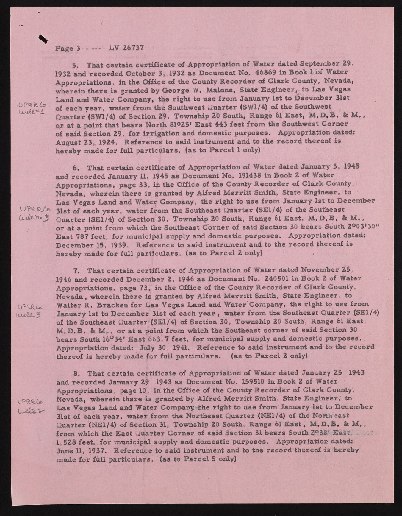
V LV 26737 ,OPRR.£© UPftJRZo OPARt* Ilu£a*5 UPR.R.£® b > 4 v 5. That certain certificate of Appropriation of Water dated September 29, 1932 and recorded October 3, 1932 as Document No. 46869 in Book 1 of Water Appropriations, in the Office of the County Recorder of Clark County, Nevada, wherein there is granted by George W. Malone, State Engineer, to Las Vegas Land and Water Company, the right to use from January 1st to December 31st of each year, water from the Southwest Quarter (SW1/4) of the Southwest Quarter (SW1/4) of Section 29, Township 20 South, Range 61 E a st, M .D .B . & M ., or at a point that bears North 81025' E ast 443 feet from the Southwest Corner of said Section 29, for irrigation and domestic purposes. Appropriation dated: August 23, 1924. Reference to said instrument and to the record thereof is hereby made for full particulars, (as to P arcel 1 only) 6. That certain certificate of Appropriation of Water dated January 5, 1945 and recorded January 11, 1945 as Document No. 191438 in Book 2 of Water Appropriations, page 33, in the Office of the County Recorder of Clark County, Nevada, wherein there is granted by Alfred M erritt Smith, State Engineer, to Las Vegas Land and Water Company, the right to use from January 1st to December 31st of each year, water from the Southeast Quarter (SE1/4) of the Southeast Quarter (SE1/4) of Section 30, Township 20 South, Range 61 E ast, M .D .B , It M ., or at a point from which the Southeast Corner of said Section 30 bears South 2o03'3Q" E ast 787 feet, for municipal supply and domestic purposes. Appropriation dated: December 15, 1939. Reference to said instrument and to the record thereof is hereby made for full particulars, (as to P arcel 2 only) 7. That certain certificate of Appropriation of Water dated November 25; 1946 and recorded December 2, 1946 as Document No. 240501 in Book 2 of Water Appropriations, page 73, in the Office of the County Recorder of Clark County, Nevada, wherein there is granted by Alfred M erritt Smith, State Engineer, to Walter R. Bracken for Las Vegas Land and Water Company, the right to use from January 1st to December 31st of each y e a r , water from the Southeast Quarter (SE1/4) of the Southeast Quarter (SE1/4) of Section 30, Township 20 South, Range 61 E ast, M .D .B . It M. , or at a point from which the Southeast corner of said Section 30 bears South 16°34' E ast 663. 7 feet, for municipal supply and domestic purposes. Appropriation dated: July 30, 1941. Reference to said instrument and to the record thereof is hereby made for full particulars. (as to P arcel 2 only) 8. That certain certificate of Appropriation of Water dated January 25 1943 and recorded January 29 1943 as Document No. 159510 in Book 2 of Water Appropriations, page 10, in the Office of the County Recorder of Clark County, Nevada, wherein there is granted by Alfred M erritt Smith, State Engineer,’ to Las Vegas Land and Water Company tthe right to use from January 1st to December 31st of each year, water from the Northeast Quarter (NE1/4) of the Northeast Quarter (NE1/4) of Section 31, Township 20 South, Range 61 E a s t, M .D .B . & M ., from which the E ast quarter Corner of said Section 31 bears South 2°38' East,1 1,528 feet, for municipal supply and domestic purposes. Appropriation dated: June 11, 1937. Reference to said instrument and to the record thereof is hereby made for full particulars, (as to P arcel 5 only)

