Copyright & Fair-use Agreement
UNLV Special Collections provides copies of materials to facilitate private study, scholarship, or research. Material not in the public domain may be used according to fair use of copyrighted materials as defined by copyright law. Please cite us.
Please note that UNLV may not own the copyright to these materials and cannot provide permission to publish or distribute materials when UNLV is not the copyright holder. The user is solely responsible for determining the copyright status of materials and obtaining permission to use material from the copyright holder and for determining whether any permissions relating to any other rights are necessary for the intended use, and for obtaining all required permissions beyond that allowed by fair use.
Read more about our reproduction and use policy.
I agree.Information
Digital ID
Permalink
Details
More Info
Rights
Digital Provenance
Publisher
Transcription
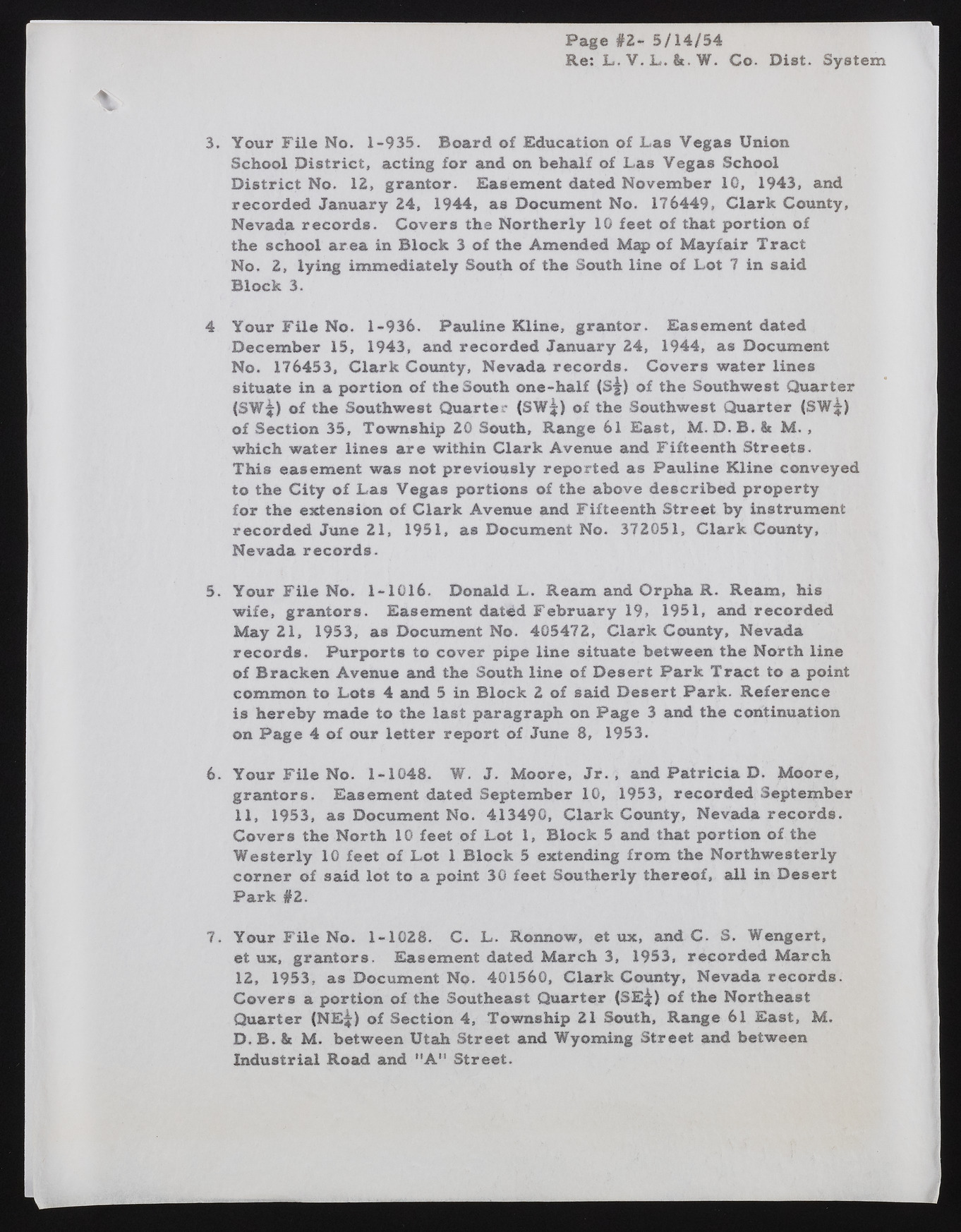
Page #2- 5/14/54 Re: L . V. 1*.&. W. Co. Diet. System 3. Your File No. 1-935. Board of Education of Las Vegas Union School District, acting for and on behalf of Las Vegas School District No. 12, grantor. Easement dated November 10, 1943, and recorded January 24, 1944, as Document No. 176449, Clark County, Nevada records. Covers the Northerly 10 feet of that portion of the school area in Block 3 of the Amended Map of Mayfair Tract No. 2, lying immediately South of the South line of Lot 7 in said Block 3. 4 Your File No. 1-936. Pauline Kline, grantor. Easement dated December 15, 1943, and recorded January 24, 1944, as Document No. 176453, Clark County, Nevada records. Covers water lines situate in a portion of the South one-half (s£) of the Southwest Quarter (SW^) of the Southwest Quarter (SW^) of the Southwest Quarter (SW^) of Section 35, Township 20 South, Range 61 East, M. D. B. & M. , which water lines are within Clark Avenue and Fifteenth Streets. This easement was not previously reported as Pauline Kline conveyed to the City of Las Vegas portions of the above described property for the extension of Clark Avenue and Fifteenth Street by instrument recorded June 21, 1951, as Document No. 372051, Clark County, Nevada records. 5. Your File No. 1-1016. Donald L. Ream and Orpha R. Ream, his wife, grantors. Easement dated February 19, 1951, and recorded May 21, 1953, as Document No. 405472, Clark County, Nevada records. Purports to cover pipe line situate between the North line of Bracken Avenue and the South line of Desert Park Tract to a point common to Lots 4 and 5 in Block 2 of said Desert Park. Reference is hereby made to the last paragraph on Page 3 and the continuation on Page 4 of our letter report of June 8, 1953. 6. Your File No. 1-1048. W. J. Moore, J r., and Patricia D. Moore, grantors. Easement dated September 10, 1953, recorded September 11, 1953, as Document No. 413490, Clark County, Nevada records. Covers the North 10 feet of Lot 1, Block 5 and that portion of the Westerly 10 feet of Lot 1 Block 5 extending from the Northwesterly corner of said lot to a point 30 feet Southerly thereof, all in Desert Park #2. 7. Your File No. 1-1028. C. L. Ronnow, et ux, and C. S. Wengert, et ux, grantors. Easement dated March 3, 1953, recorded March 12, 1953, as Document No. 401560, Clark County, Nevada records. Covers a portion of the Southeast Quarter (SE^) of the Northeast Quarter (NE^) of Section 4, Township 21 South, Range 61 East, M. D. B. &t M. between Utah Street and Wyoming Street and between Industrial Road and MA " Street.

