Copyright & Fair-use Agreement
UNLV Special Collections provides copies of materials to facilitate private study, scholarship, or research. Material not in the public domain may be used according to fair use of copyrighted materials as defined by copyright law. Please cite us.
Please note that UNLV may not own the copyright to these materials and cannot provide permission to publish or distribute materials when UNLV is not the copyright holder. The user is solely responsible for determining the copyright status of materials and obtaining permission to use material from the copyright holder and for determining whether any permissions relating to any other rights are necessary for the intended use, and for obtaining all required permissions beyond that allowed by fair use.
Read more about our reproduction and use policy.
I agree.Information
Digital ID
Permalink
Details
More Info
Rights
Digital Provenance
Publisher
Transcription
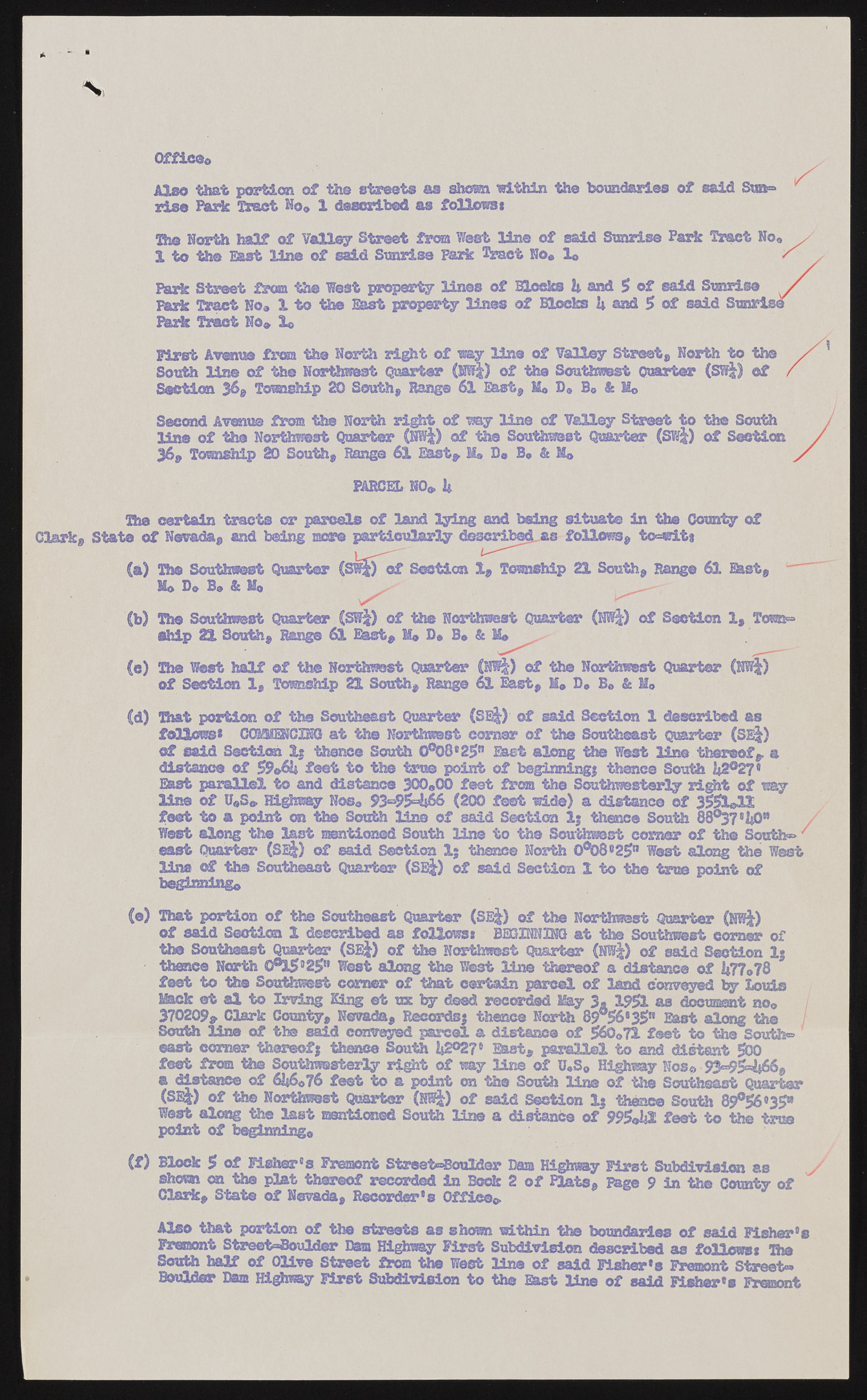
Office* that portion of the streets as shorn within the boundaries of said Stab rise Park Tract No* 1 described as follows* Th© North half of Valley Street from West line of said Sunrise Park Trsr" 1 to the East line of said Sunrise Park Tract No* lo Park Street from the West property lines of Slocks 2* and 5 of said Sunr Bark Tract No* 1 to the East property lines of Blocks U and 5 of said S Park Tract No* lo First Avenue from the North right of my line of Valley Street, North to the South line of the Northwest Quarter (Wf?) of the Southwest Quarter (SW|) of Section 36, Tomship 20 South, Range 61 East, Ho D« B* & Mo Second Avenue from the North right of way line of Valley Street to the South of the Northwest Quarter (NW|) of the Southwest Quarter (SW|) of Section 36, Township 20 South, Range 61 East* II* B« B* & M* The certain tracts or parcels of land lying and being situate in the County of Clark, State of Nevada* and being mere particularly described as follows* tcMwit* (b) The Southwest Quarter (SW£) of the Northwest Quarter (NWj) of Section 1, Town® Ship ZL South, Range 61 East, M* D* B« & M* of Section 1, Township 21 South, Range 61 East, H* D* B» & Mo (d) That portion of the Southeast Quarter (SE$) of said Section 1 described as follows* CCHOffiSOING at the Northwest comer of the Southeast Quarter (SE|) of said Section 1; thence South 0°08*25n East along the West line thereof, a distance of 59&6U feet to the true point of beginning} thence South U2®27* East parallel to and distance 300*00 feet from the Southwesterly right of way line of U*S« Highway Nos* 93^9^66 (200 feet wide) a distance of 3551*11 feet to a point cm the South line of said Section Ij thence South 88°37*1|0* West along the last mentioned South line to the Southwest corner of the Souths east Quarter (SE&) of said Section 1; thence North 0°08c25n West along the West line of the Southeast Quarter (SE-|) of said Section 1 to th© true point of beginning* (©) That portion of the Southeast Quarter (SEj) of the Northwest Quarter (NWj) of said Section 1 described as follows* BECOMING at the Southwest comer of the Southeast Quarter (SEi) of the Northwest Quarter (NW|) of said Section 1} thence North 0®i5925tt West along the West line thereof a distance of 1*77*78 feet to the Southwest comer of that certain parcel of land conveyed by Louis Mack et al to Irving King et tnc by deed recorded May 3. 1951 as document no* 370209, Clark County, Nevada, Records} thence North 89056#35n East along the / South line of the said conveyed parcel a distance of 560*71 feet to th© South® east corner thereof} thence South U2°27' East, parallel to and distant 500 feet from the Southwesterly right of way line of U*S* Highway Nos* 93=954*66, a distance of 62*6*76 feet to a point on the South line of the Southeast Quarter (SE|) of the Northwest Quarter (NWj) of said Section 1} thane© South 89°56«35* West along the last mentioned South line a distance of 995©1j2 feet to the true point of beginning* (f) Block 5 of Fiahar's Fremont Street<=touldar Bam Highway First Subdivision as shown on -tea plat thereof recorded in took 2 of Hats, Page 9 in the County of Clark, State of Nevada, Recorder's Office* Also that portion of the streets as shown within the boundaries of said Fisher's Fremont Street=8oulder Dam Highway First Subdivision described as follows* Die South half of Olive Street from the West line of said Fisher's Fremont Street® PARCEL NO*. 2» Mo D* B* & M* (e) The West half of the Northwest Quarter (NW|) of the Northwest Quarter (NWj) Boulder Dam Highway First Subdivision to the East line of said Fisher's Fremont

