Copyright & Fair-use Agreement
UNLV Special Collections provides copies of materials to facilitate private study, scholarship, or research. Material not in the public domain may be used according to fair use of copyrighted materials as defined by copyright law. Please cite us.
Please note that UNLV may not own the copyright to these materials and cannot provide permission to publish or distribute materials when UNLV is not the copyright holder. The user is solely responsible for determining the copyright status of materials and obtaining permission to use material from the copyright holder and for determining whether any permissions relating to any other rights are necessary for the intended use, and for obtaining all required permissions beyond that allowed by fair use.
Read more about our reproduction and use policy.
I agree.Information
Digital ID
Permalink
Details
More Info
Rights
Digital Provenance
Publisher
Transcription
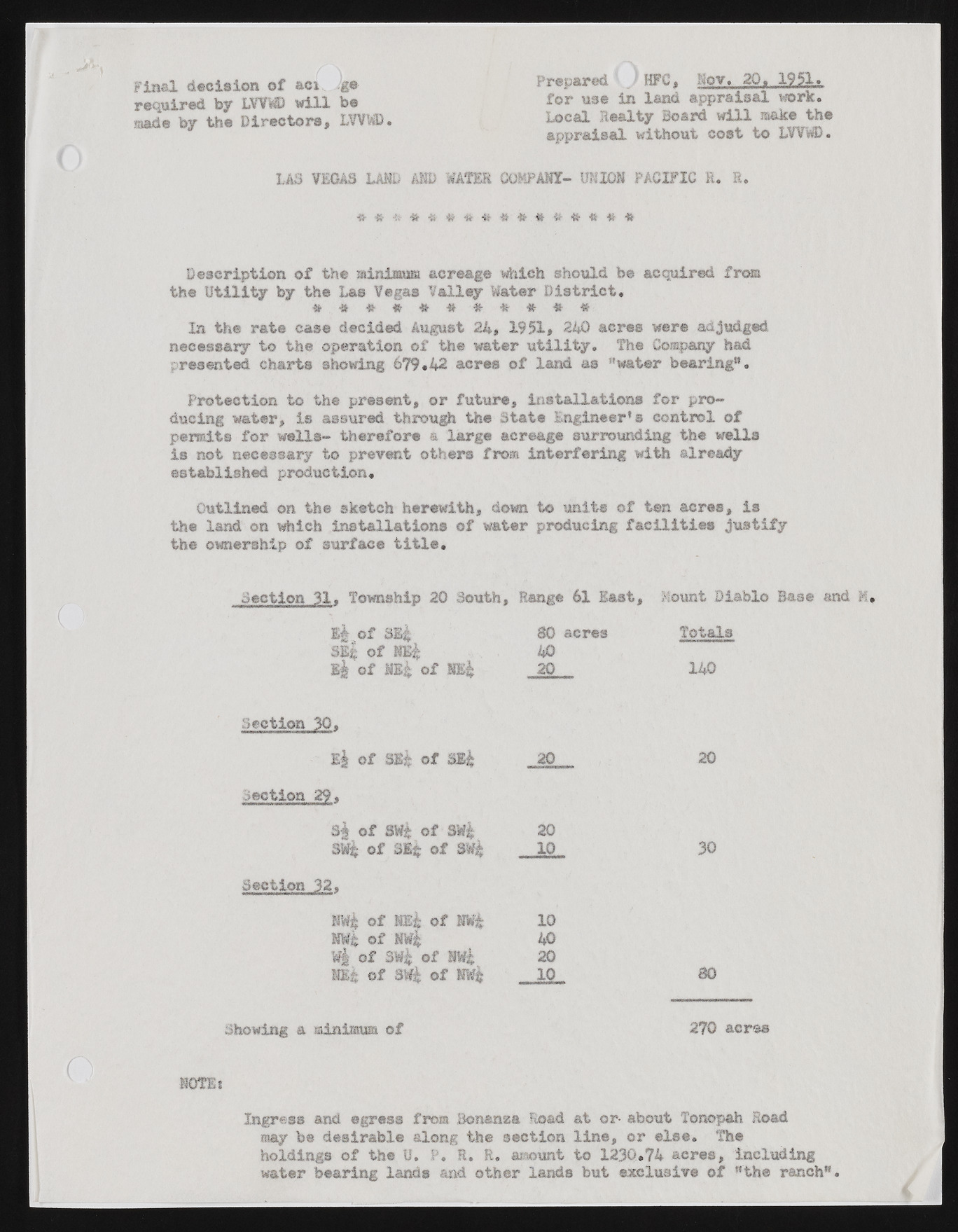
Final decision of aci ge required by LVVWD will be made by the Directors, LVVWD. U S VEGAS LAUD AMD WATER Prepared . HFC, Nov. 20. 1951. for use in land appraisal work. Local Jie<y Board will make the appraisal without cost to LVVWD. COMPANY- UNION PACIFIC R. R. Description o f the minimum acreage which should be acquired from the U t ilit y by the Las Vegas Valley Water D is t r ic t . In the rat® case decided August 24, 1951, 240 acres were adjudged necessary to the operation o f the water u t ilit y . The Company had presented charts showing 679.42 acres o f land as "water bearing*1. Protection to the present, or future, installations for producing water, is assured through the State Engineer’s control of permits for wells- therefore a large acreage surrounding the wells is not necessary to prevent others from interfering with already established production. Outlined on the sketch herewith, down to units of ten acres, is the land on which installations of water producing facilities justify the ownership of surface title. Section 31. Township 20 South, Range 61 East, Mount Diablo E| o f SEi 80 acres Totals SS$ o f 40 k| o f o f m i 20 140 Section 30. E| o f SE| o f SE| 20 20 Section 29, S| o f 8M$ o f §¥§ 20 SW$ o f 31$ o f SWjfe 10 30 Section 32. awl o f m i o f nw$ 10 ® it o f tnr| 40 o f sw$ of m i 20 m k o f SW$ o f HW$ - IQ 80 Showing a minimum of 2?0 acres NOTE i Ingress and egress from Bonanza Road at or- about Tonopah Road may be desirable along the section line, or else. The holdings of the U. P. R, R. amount to 1230.74 acres, including water bearing lands and other lands but exclusive of "the ranch".

