Copyright & Fair-use Agreement
UNLV Special Collections provides copies of materials to facilitate private study, scholarship, or research. Material not in the public domain may be used according to fair use of copyrighted materials as defined by copyright law. Please cite us.
Please note that UNLV may not own the copyright to these materials and cannot provide permission to publish or distribute materials when UNLV is not the copyright holder. The user is solely responsible for determining the copyright status of materials and obtaining permission to use material from the copyright holder and for determining whether any permissions relating to any other rights are necessary for the intended use, and for obtaining all required permissions beyond that allowed by fair use.
Read more about our reproduction and use policy.
I agree.Information
Digital ID
Permalink
Details
Member of
More Info
Rights
Digital Provenance
Publisher
Transcription
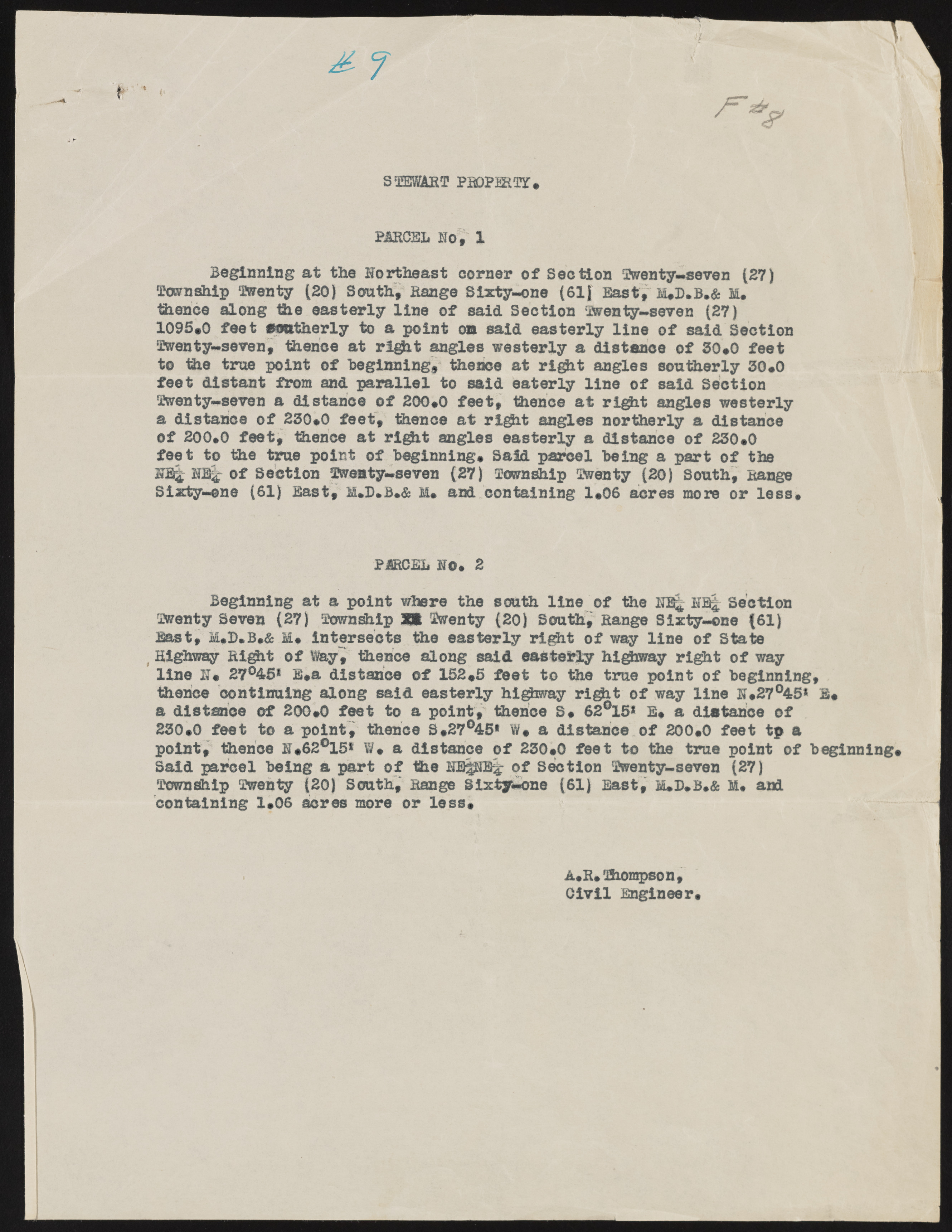
) S- f STEWART PBOPMTf , PARCEL NO , X Beginning at the Northeast corner of Section Twenty—seven (27) Tavnship Twenty (20) South, Range Sixty-one (61) East, M,D.B.& m . thence along the easterly line of said Section Twenty— seven (27) 1095,0 feet southerly to a point ou said easterly line of said Section Twenty-seven, thence at rlgit angles westerly a distance of 30,0 feet to the true point of Beginning, thence at right angles southerly 30,0 feet distant from and parallel to said eaterly line of said Section Twenty-seven a distance of 200,0 feet, thence at rigit angles westerly a distance of 230,0 feet, thence at right angles northerly a distance of 200,0 feet, thence at rlgit angles easterly a distance of 230,0 feet to the true point of Beginning, Said parcel Being a part of the NJ% of Section Twenty-seven (27) Township Twenty (20) South, Range Sixty-ene (61) East, M.D.B.& M, and containing 1,06 acres more or less. PARCEL NO, 2 Beginning at a point where the south line of the NR£ NR| Section Twenty Seven (27) Township XK Twenty (20) Souths Range Sixty-one (61) East, M,B,B,& M, intersects the easterly right of way line of State Highway Right of Way, thence along said easterly highway right of way line N, 27°45* E,a distance of 152,5 feet to the true point of Beginning, thence continuing along said easterly highway right of way line N,27°45* E, a distance of 200,0 feet to a point, thence S, 62°15* E, a distance of 230,0 feet to a point, thence S,27°45* W, a distance of 200,0 feet tp a point, thence N,62°15* W, a distance of 230,0 feet to the true point of Beginning, Said parcel Being a part of the NEgNEl: of Section Twenty-seven (27) Township Twenty (20) South, Range Sixty-one (61) East, M»D,B,& M« and containing 1,06 acres more or less, 1 - < - A,R, Thompson , Civil Engineer,

