Copyright & Fair-use Agreement
UNLV Special Collections provides copies of materials to facilitate private study, scholarship, or research. Material not in the public domain may be used according to fair use of copyrighted materials as defined by copyright law. Please cite us.
Please note that UNLV may not own the copyright to these materials and cannot provide permission to publish or distribute materials when UNLV is not the copyright holder. The user is solely responsible for determining the copyright status of materials and obtaining permission to use material from the copyright holder and for determining whether any permissions relating to any other rights are necessary for the intended use, and for obtaining all required permissions beyond that allowed by fair use.
Read more about our reproduction and use policy.
I agree.Information
Digital ID
Permalink
Details
Member of
More Info
Rights
Digital Provenance
Publisher
Transcription
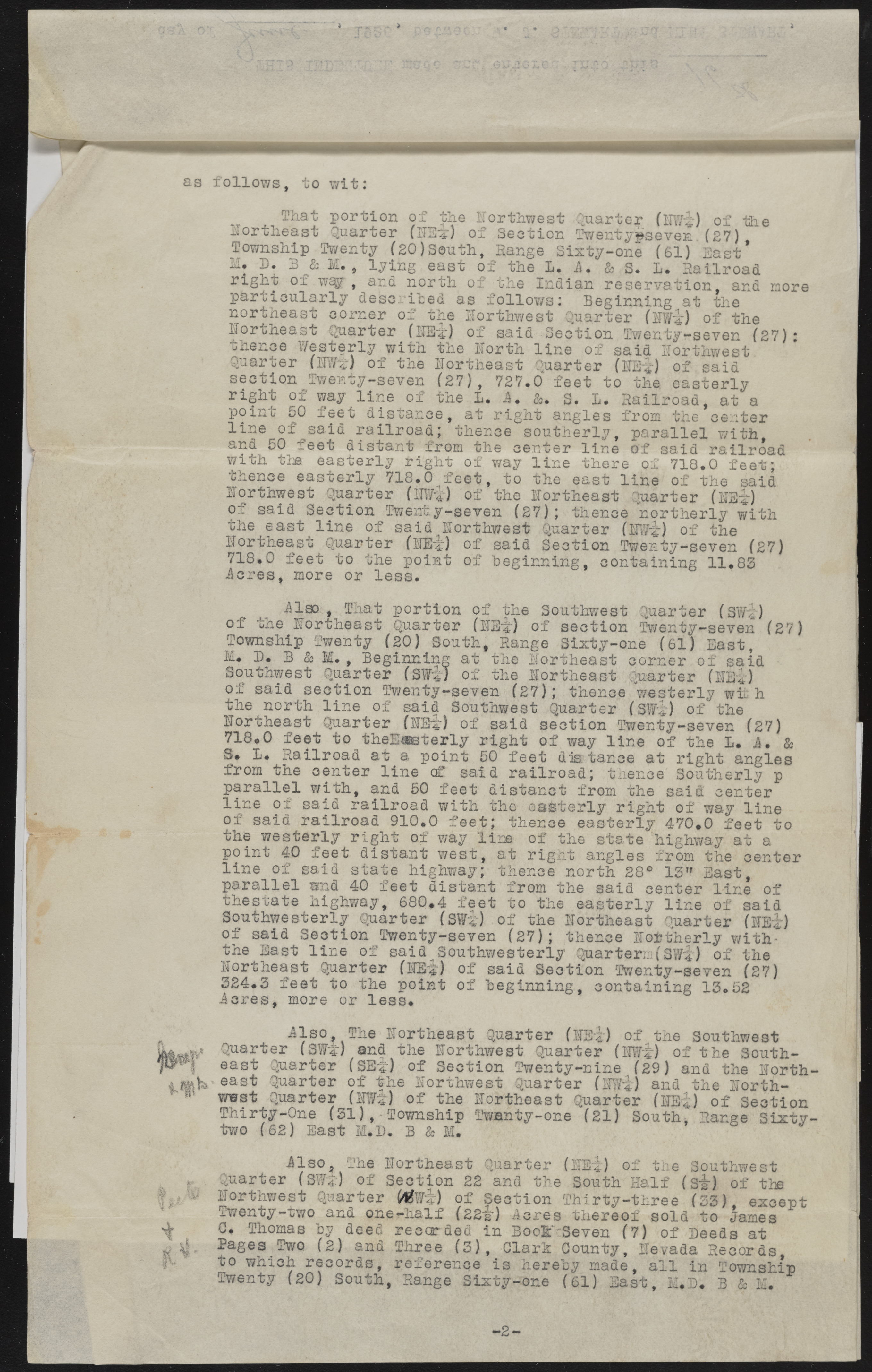
i # as follows, to wit: That portion of the northwest -Quarter of the northeast Quarter (lEt) of Section Twentypseven.(27) Township Twenty (20)South, Range Sixty-one (61) East * M. D. B & M . , lying east of the I. A, & S. 1. Railroad right of w£$[ , and north of the Indian reservation, and particularly described as follows: Beginning at the Quarter (WSi) of the more northeast corner of the northwest northeast Quarter (HB||) of said Section Twenty-seven (27) thence Westerly with the north line of said northwest Quarter (1JW>J of the northeast Quarter (lEi) of said section Twenty-seven (27), 727.0 feet to the easterly right of way line of the 1 . i. &. s. L. Railroad, at a point 50 feet distance, at right angles from the center line of^said railroad; thence southerly, parallel with and 50 feet distant from the center line of said railroad with the easterly right of way line there ox 718.0 feet; thence easterly 718.0 feet, to the east line of the said northwest Quarter (mi) of the northeast Quarter (lEf) of said Section Twenty-seven (27); thence "northerly with the east line of said northwest Quarter (Ilfi) of the northeast Quarter (iBi) of said Section Twenty-seven (27) 718.0 feet to the point of beginning, containing 11.83 ieres, more or less. of ilso , That portion of the Southwest Quarter (SWi) the northeast Quarter (HE'i) of section Twenty-seven (27) Township Twenty (20) South, Range Sixty-one (61) East, M. D. B & M . , Beginning at the northeast corner of said Southwest Quarter (SWi) of the northeast Quarter (HEi) of said section Twenty-seven (27); thence westerly with the north line of said Southwest Quarter (SHi) of the northeast Quarter (HE*) of said section Twenty-seven (27) 718*0- feet to theE®sterly right of way line of the L* i. & S. L. Railroad at a point 50 feet dis tance at right angles from the center line of said railroad; thence Southerly p parallel with, and 50 feet distanct from the said center line of said railroad with the easterly right of way line of said railroad 910.0 feet; thence easterly 470*0 feet to the westerly right of way line of the state highway at a point 40 feet distant west, at right angles from the center line of said state highway; thence north 28° 13” East, parallel and 40 feet distant from the said center line of thestate highway, 680*4 feet to the easterly line of said Southwesterly Quarter (SWi) of the northeast Quarter (HEi) of said Section Twenty-seven (27); thence northerly with* the East line of said Southwesterly Quartern(SWi) of the northeast Quarter (HEi) of said Section Twenty-seven (27) i3c2r4e.s3, fmeoerte too r tlhees sp.oint of beginning, containing 13.52 fp# r a w , if? east east wwst ilso. The northeast Quarter (IE*) of the Southwest er (SVs) and the northwest Quarter (iwi) of the South- Quarter (SEi) of Section Twenty-nine (29) and the north Quarter of the northwest Quarter (Ifi) and the Rorth- wws-c yuarver usw«j) otf the northeast Quarter (lniBti) of Section Thirty-One (31),-Township Twenty-one (21) South* Range Sixty-two (62) East M.D. B & M 41 Quarter ilso^ The northeast Quarter 1 (SWi) of Section 22 and the northwest Quarter of Section Twenty-two and one-half (22i) icres C. Thomas by deed recorded in Bool"-: Pages Two (2 ) and Three (3 ), Clark to which records, reference is here Twenty (20) South, Range Sixty-one (HE4:) of the Southwest South Half (Sir) of the Thirty-three (53), except thereof sold to James Seven (7) of Deeds at County, Hevada Records, by made, all in Township (61) East, M.D. B & M. -2-

