Copyright & Fair-use Agreement
UNLV Special Collections provides copies of materials to facilitate private study, scholarship, or research. Material not in the public domain may be used according to fair use of copyrighted materials as defined by copyright law. Please cite us.
Please note that UNLV may not own the copyright to these materials and cannot provide permission to publish or distribute materials when UNLV is not the copyright holder. The user is solely responsible for determining the copyright status of materials and obtaining permission to use material from the copyright holder and for determining whether any permissions relating to any other rights are necessary for the intended use, and for obtaining all required permissions beyond that allowed by fair use.
Read more about our reproduction and use policy.
I agree.Information
Digital ID
Permalink
Details
More Info
Rights
Digital Provenance
Publisher
Transcription
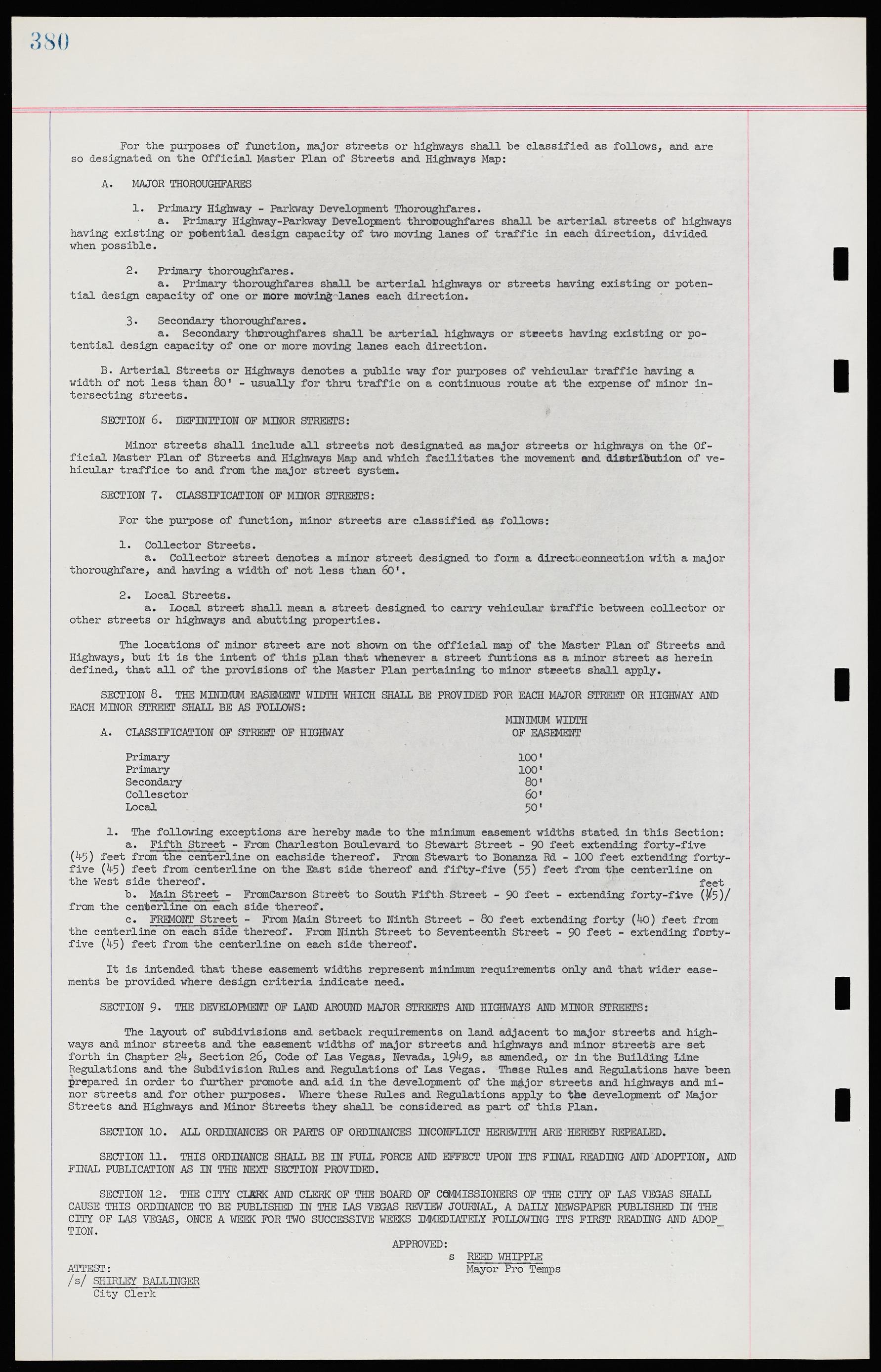
For the purposes of function, major streets or highways shall be classified as follows, and are so designated on the Official Master Plan of Streets and Highways Map: A. MAJOR THOROUGHFARES 1. Primary Highway - Parkway Development Thoroughfares. a. Primary Highway-Parkway Development thoroughfares shall be arterial streets of highways having existing or potential design capacity of two moving lanes of traffic in each direction, divided when possible. 2. Primary thoroughfares. a. Primary thoroughfares shall be arterial highways or streets having existing or potential design capacity of one or more moving lanes each direction. 3. Secondary thoroughfares. a. Secondary thoroughfares shall be arterial highways or streets having existing or potential design capacity of one or more moving lanes each direction. B. Arterial Streets or Highways denotes a public way for purposes of vehicular traffic having a width of not less than 80' - usually for thru traffic on a continuous route at the expense of minor intersecting streets. SECTION 6. DEFINITION OF MINOR STREETS: Minor streets shall include all streets not designated as major streets or highways on the Official Master Plan of Streets and Highways Map and which facilitates the movement and distribution of vehicular traffic to and from the major street system. SECTION 7. CLASSIFICATION OF MINOR STREETS: For the purpose of function, minor streets are classified as follows: 1. Collector Streets. a. Collector street denotes a minor street designed to form a direct connection with a major thoroughfare, and having a width of not less than 60'. 2. Local Streets. a. Local street shall mean a street designed to carry vehicular traffic between collector or other streets or highways and abutting properties. The locations of minor street are not shown on the official map of the Master Plan of Streets and Highways, but it is the intent of this plan that whenever a street functions as a minor street as herein defined, that all of the provisions of the Master Plan pertaining to minor streets shall apply. SECTION 8. THE MINIMUM EASEMENT WIDTH WHICH SHALL BE PROVIDED FOR EACH MAJOR STREET OR HIGHWAY AND EACH MINOR STREET SHALL BE AS FOLLOWS: MINIMUM WIDTH A. CLASSIFICATION OF STREET OF HIGHWAY OF EASEMENT Primary 100' Primary 100' Secondary 80' Collector 60’ Local 50' 1. The following exceptions are hereby made to the minimum easement widths stated in this Section: a. Fifth Street - From Charleston Boulevard to Stewart Street - 90 feet extending forty-five (45) feet from the centerline on each side thereof. From Stewart to Bonanza Rd - 100 feet extending forty- five (45) feet from centerline on the East side thereof and fifty-five (55) feet from the centerline on the West side thereof. b. Main Street - From Carson Street to South Fifth Street - 90 feet - extending forty-five (45) feet from the centerline on each side thereof. c. FREMONT Street - From Main Street to Ninth Street - 80 feet extending forty (40) feet from the centerline on each side thereof. From Ninth Street to Seventeenth Street - 90 feet - extending forty- five (45) feet from the centerline on each side thereof. It is intended that these easement widths represent minimum requirements only and that wider easements be provided where design criteria indicate need. SECTION 9. THE DEVELOPMENT OF LAND AROUND MAJOR STREETS AND HIGHWAYS AND MINOR STREETS: The layout of subdivisions and setback requirements on land adjacent to major streets and highways and minor streets and the easement widths of major streets and highways and minor streets are set forth in Chapter 24, Section 26, Code of Las Vegas, Nevada, 1949, as amended, or in the Building Line Regulations and the Subdivision Rules and Regulations of Las Vegas. These Riles and Regulations have been prepared in order to further promote and aid in the development of the major streets and highways and minor streets and for other purposes. Where these Rules and Regulations apply to the development of Major Streets and Highways and Minor Streets they shall be considered as part of this Plan. SECTION 10. ALL ORDINANCES OR PARTS OF ORDINANCES INCONFLICT HEREWITH ARE HEREBY REPEALED. SECTION 11. THIS ORDINANCE SHALL BE IN FULL FORCE AND EFFECT UPON ITS FINAL READING AND ADOPTION, AND FINAL PUBLICATION AS IN THE NEXT SECTION PROVIDED. SECTION 12. THE CITY CLERK AND CLERK OF THE BOARD OF COMMISSIONERS OF THE CITY OF LAS VEGAS SHALL CAUSE THIS ORDINANCE TO BE PUBLISHED IN THE LAS VEGAS REVIEW JOURNAL, A DAILY NEWSPAPER PUBLISHED IN THE CITY OF LAS VEGAS, ONCE A WEEK FOR TWO SUCCESSIVE WEEKS IMMEDIATELY FOLLOWING ITS FIRST READING AND ADOP TION. APPROVED: s REED WHIPPLE ATTEST: Mayor Pro Temps /s/ SHIRLEY BALLINGER City Clerk

