Copyright & Fair-use Agreement
UNLV Special Collections provides copies of materials to facilitate private study, scholarship, or research. Material not in the public domain may be used according to fair use of copyrighted materials as defined by copyright law. Please cite us.
Please note that UNLV may not own the copyright to these materials and cannot provide permission to publish or distribute materials when UNLV is not the copyright holder. The user is solely responsible for determining the copyright status of materials and obtaining permission to use material from the copyright holder and for determining whether any permissions relating to any other rights are necessary for the intended use, and for obtaining all required permissions beyond that allowed by fair use.
Read more about our reproduction and use policy.
I agree.Information
Digital ID
Permalink
Details
Member of
More Info
Rights
Digital Provenance
Publisher
Transcription
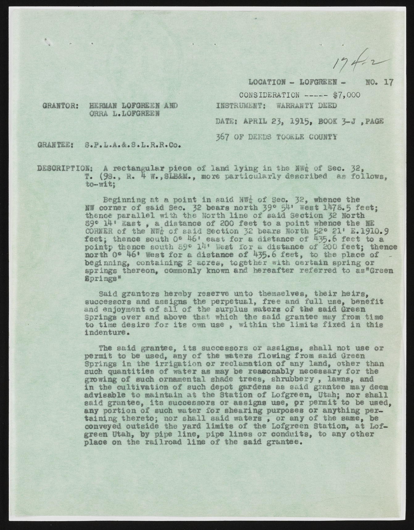
f / LOCATION - LOFGREEN NO. 17 CONSIDERATION INSTRUMENT; WARRA. $7,000 GRANTOR: HERMAN LGFGREEN AND ORBA L.LGFGREEN WARRANTY DEED DATE: APRIL 23, 1915* BOOK 3 -J ,FAGE 367 OF DEEDS TOOELE COUNTY GRANTEE: S .P .L .A .& .S .L .R .R .C o. DESCRIPTION: A recta n gu la r p ie c e o f land ly in g in the NW$ o f Sec. 32* T. (9S«* R® 4 W* , SLB&M., more p a r t ic u la r ly d escrib ed as fo llo w s , t o -ik t ; Beginning at a p o in t in said o f See. JS, whence the NS corn er o f sa id Sec. 32 hears n orth 39° 5&* West 1%7$*5 f e e t ; thence p a r a lle l with the North lin e o f sa id S e ctio n )2 North 89® 3&* l a s t , a d ista n ce o f 200 fe e t to a p o in t whence the 11 CORNER o f the lff| o f s a id S ection 32 bears North 52° 21* £ .1 9 1 0 .9 f e e t ; thence south 0® ea st fo r a d istan ce o f A35.6 fe e t to a p oin tp thence south ©9® 1^* west f o r a d ista n ce o f 200 f e e t ; thence north 0® k6* Went fo r a d ista n ce o f f e e t , to the p la ce o f - beginning, con tain in g 2 a c r e s , tog eth er with c e r ta in sp rin g o r sp rin gs thereon, commonly known and h erea fter r e fe r re d to as*6reen Springs* Said gra n tors hereby reserve unto them selves, th e ir h e ir s , su ccessors and assign s the p erp etu a l, fr e e and f u l l use, b e n e fit and enjoyment o f a l l o f the surplus waters o f the s a id Green Springs ov er and above that which the sa id grantee may from time to time d e s ir e fo x i t s own use , w ith in the lim it s fir e d in th is indenture. The s a id grantee, i t s su ccessors or a s sig n s, s h a ll not use o r perm it to be used, any o f the waters flow in g from sa id Green Springs in the ir r ig a t io n o r reclam ation o f any land, o th er than such q u a n titie s o f water as may be reasonably n ecessary f o r the growing o f such ornamental shade tr e e s , shrubbery , lawns, and in the c u lt iv a t io n o f such depot gardens as sa id grantee may deem ad visa b le t o m aintain a t the S ta tio n o f Lofgreen, Utah; n or s h a ll sa id gran tee, i t s su ccessors or a ssig n s use, p r perm it to be used, any p o r tio n o f such water f o r sh earin g purposes o r anything perta in in g th e r e to ; nor s h a ll sa id waters , or any o f the same, be conveyed o u tsid e the yard lim it s o f the Lofgreen S ta tion , a t L o f-green Utah, by pipe l in e , pipe lin e s o r co n d u its, to any o th e r plane on the r a ilr o a d lin e o f the sa id gran tee.

