Search the Special Collections and Archives Portal
Search Results
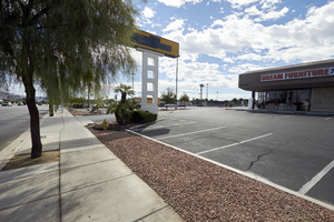
Businesses on East Sahara Avenue near South Eastern Avenue looking east, Las Vegas, Nevada: digital photograph
Date
2017-09-13
Archival Collection
Description
Businesses in a large shopping center on the southwest corner of South Eastern Avenue and East Sahara Avenue.
Image
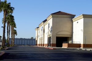
Empty commercial property at East Sahara Avenue and Maryland Parkway, Las Vegas, Nevada: digital photograph
Date
2017-09-12
Archival Collection
Description
A retail box store sits empty on the southwest corner of East Sahara Avenue at Maryland Parkway.
Image
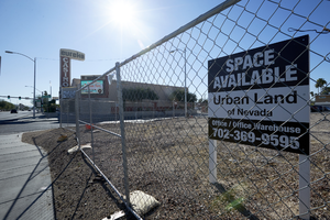
Vacant land for sale on East Sahara Avenue at Sherwood Street looking east, Las Vegas, Nevada: digital photograph
Date
2017-09-12
Archival Collection
Description
Vacant land available for a project located on the southwest corner of East Sahara Avenue at Sherwood Street.
Image
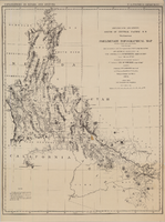
Map of explorations and surveys south of the Central Pacific Railroad made by the U.S. Army Corps of Topographical Engineers, 1871
Date
1871
Description
'Preliminary topographical map embracing in skeleton a portion only of the notes from surveys made in accordance with Par.II Special Orders No. 109 War Dept., March 18th, 1871 and letter of instructions of Brig. General A.A. Humphreys, Chief of Eng'rs. dated March 23rd, 1871. Conducted under the immediate direction of 1st Lieutenant Geo. M. Wheeler, Corps of Eng'rs., assisted by 1st Lieutenant D.W. Lockwood, Corps of Eng'rs. and 2nd Lieutentant D.A. Lyle, 2nd U.S. Artillery, during the summer and fall of 1871. Louis Nell, chief topographer and draughtsman.'' At head of map: 'Explorations in Nevada and Arizona. U.S. Engineer Department.' In lower left corner: 'Note: This map is a hasty and partial compilation from the topographical data already received, many still remaining en route. Upon it is projected in skeleton the groundwork of the area examined. All points except the prominent astronomical positiions are subject to lsight modification upon the final map.' Shows area through central Nevada, eastern California, and central Arizona. Relief shown by hachures. Published by the War Dept. Scale [ca. 1:1,520,640]. 1 in. to 24 miles (W 118°--W 109°/N 41°--N 32°).
Image
Pagination
Refine my results
Content Type
Creator or Contributor
Subject
Archival Collection
Digital Project
Resource Type
Year
Material Type
Place
Language
Records Classification

