Search the Special Collections and Archives Portal

Search Results
Display    Results Per Page
Displaying results 51 - 60 of 108

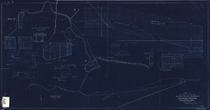
Blueprint showing proposed improvement of Las Vegas Springs, Las Vegas, Nevada, September 21, 1916

Date

1916-09-21

Description

'Exhibit A'. 'Approved Sept. 21, 1916.' '2-N-1719' handwritten in lower right corner. 'W.E.J."--Lower left corner. "L-44 - 50 to 61. T-75 - 17 & 46"--Upper left corner. Includes discharge figures and plans for improvements to springs. Scale [ca. 1:240]. 1 in. to 20 feet. -- Scale [ca. 1:2,400]. 1 in. to 200 ft. Vertical scale [ca. 1:48]. 1 in. to 4 feet. -- Scale [ca. 1:4,800]. 1 in. to 100 feet. 1 map. Contents: Detail at springs -- Profile -- Alignment.

Image
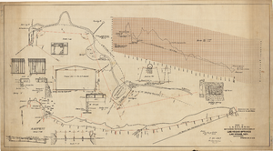
Map showing proposed improvements of Las Vegas Springs, Las Vegas, Nevada, January 26, 1918

Date

1918-01-26

Description

'Exhibit A'. 'Approved Jan. 26, 1918.' Includes discharge figures and plans for improvements to springs for the municipal water system including diagrams of spillway openings, etc. Scale [ca. 1:1200] 1 in.=100 feet -- Scale [ca. 1:120] 1 in.=10 feet -- Scale [ca. 1:240] 1 in.=20 feet -- Scale [ca. 1:24] 1 in.=2 feet -- Scale [ca. 1:2400] 1 in.=200 feet. Vertical scale [ca. 1:48] 1 in.=4 feet -- Scale [ca. 1:12] 1 in.=1 foot.

Image
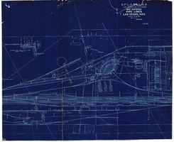
Map showing water pipelines, Las Vegas, Nevada, January 15, 1914

Date

1914-01-15

Description

'S.P.L.A.&S.L.R.R., Los Angeles Division.' 'Jan. 15, 1914.' Includes other parts of water utilities besides pipelines such as sump pumps and water tanks. Scale varies. Blueprint. Library's copy includes hand-written notes.

Image

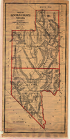
Map of Lincoln and Clark Counties, Nevada, 1908

Date

1908

Description

'Map of Lincoln County, Nevada. Compiled by H.E. Freudenthal from official surveys. Copyright, 1908, by H.E. Freudenthal.' Relief shown by hachures and spot heights. Shows range and township grid. Shows towns, railroads, proposed railroads, wagon roads and springs. Scale [ca. 1:380,160]. 1 in. to approx. 6 miles (W 116°--W 114°/N 39°--N 35°).

Image

Map showing water connection for Moapa School District No. 17, Moapa, Nevada, August 1920

Date

1920-08

Description

'Exhibit A.' 'L.A. & S.L. R.R. Co., Los Angeles Division.' 'August 1920.' 'Approved, [signed] C.F. Miller, Div. Engr.' '2-W-49' hand-printed in lower right corner.'Audit # 3309 12/31/24" hand-printed in lower left margin. Scale: 1 in. = 100 ft

Image

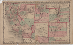
Map of California, Nevada, Utah, Colorado, Arizona & New Mexico, circa 1867

Date

1865 to 1869

Description

39 x 62 cm. Relief shown by hachures and spot heights. Prime meridian: Greenwich and Washington. Hand colored. Shows natural features, populated places, routes of mail steamships, routes of explorers, locations of Indian tribes, railroad routes, and proposed railroad routes. In top margin: No. 80-81. On verso: New Mexico, Arizona, Colorado, Idaho, Dakota (statistics and other information) and The state of California (statistics and other information). Original publisher: G.W. and C.B. Colton.

Image

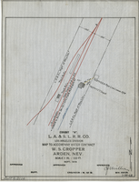
Map to accompany water contract, W. S. Cropper, Arden, Nevada, September 1919

Date

1919-09

Description

'Exhibit A. L.A. & S.L. R.R. Co., Los Angeles Division. Sept. 1919. 'Approved [signed] C.F. Miller, Div. Engr.' 'I-W-68' hand-printed in lower right corner. 'Audit No 3114" hand-printed in lower left margin. Scale 1 in. = 100 ft.

Image

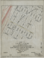
Map showing water pipeline in Clark Street, Las Vegas, Nev., August 1919

Date

1919-08

Description

'Exhibit A. L.A & S.L. R.R. Co., Los Angeles Division.' ' Las Vegas Land & Water Co., Las Vegas, Nev.' 'August 1919' (?) 'Approved [signed] C.F. Miller Div. Engr. '2-W-18.' Handwritten in lower left margin: 'Audit No.1987A. Expires 12/31/23.' Pipeline marked in yellow. Area of Las Vegas in map labeled as 'Clark's Las Vegas Townsite.' Scale: 1 in. = 400 ft.

Image

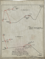
Sketch of plan and profile of present and proposed pipes and tanks and reservoirs at Sloan, Erie and Jean, Nevada, circa 1910s-1920s

Date

1910 to 1929

Description

'No scale. Approved E.M. Jessup, Engr. Maintenance. 7-R-463.'

Image

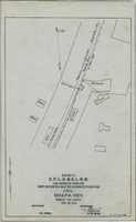
Map showing water connection for jail, Moapa, Nevada, December 28, 1914

Date

1914-12-28

Description

'Exhibit A.' 'S.P.L.A.&.S.L.R.R., Los Angeles Division.' 'Approved, [signed] E.M. Jessup, E. M. of W.' 2-T-167A' hand-printed in lower right corner. Scale: 1 in. = 100 ft.

Image