Search Results
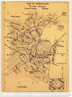
Map of Searchlight Mining District, Clark County (Nev.), 1905
Date
Description
Image
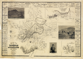
Map of the Tonopah Mining District, Nye County (Nev.), 1902
Date
Description
Image
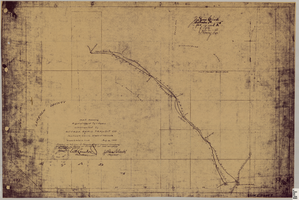
Map showing right of way of toll road constructed by Nevada Rapid Transit Co. in Lincoln County (Nev.), 1905
Date
Description
Image
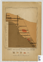
Map of a vertical cross-section through the Eureka Consolidated Mine, Eureka County (Nev.), 1883
Date
Description
Image
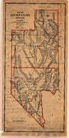
Map of Lincoln County (Nev.), 1908
Date
Description
Image
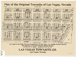
Plat map of the Original Townsite of Las Vegas (Nev.), 1903
Date
Description
Image
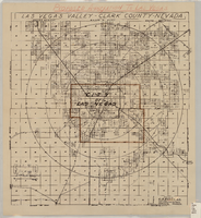
Map of the Las Vegas Valley, Clark County (Nev.). 1929
Date
Description
Image
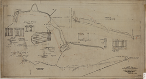
Map showing the proposed improvement of Las Vegas Springs, Las Vegas (Nev.), Clark County (Nev.), 1916
Date
Description
Scale [ca. 1:240]. 1 in. to 20 feet. -- Scale [ca. 1:2,400]. 1 in. to 200 ft. Vertical scale [ca. 1:48]. 1 in. to 4 feet. -- Scale [ca. 1:4,800]. 1 in. to 100 feet ; 1 map : col. ; 40 x 78 cm ; "Scale as noted." ; "Exhibit 'A'." ; "Approved Sept. 21, 1916." ; "Div.Engr."--Lower right corner ; "W.E.J."--Lower left corner ; "L-44-50to61. T-75-17&46."--Upper left corner ; Includes discharge figures and plans for improvements to springs ; Library's copy has "Proposed layout" written on it in pencil ; Contents: Detail at springs -- Profile -- Alignment ;
Image
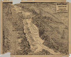
Map of Death Valley (Nev.), 1900-1925
Date
Description
Image
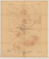
Map of the Tonopah Mining District, Tonopah (Nev.), 1910
Date
Description
Image