Search the Special Collections and Archives Portal
Search Results
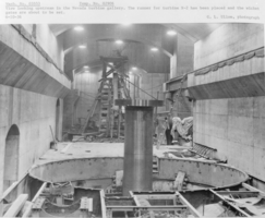
Film transparency of Nevada turbine gallery, Hoover Dam, June 10, 1936
Date
1936-06-10
Archival Collection
Description
Black and white image of Hoover Dam with the following printed description: "View looking upstream in the Nevada turbine gallery. The runner for turbine N-2 has been placed and the wicket gates are about to be set." Note: Boulder Dam was officially renamed Hoover Dam in 1947.
Image
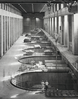
Photograph of generators, Hoover Dam, June 24, 1937
Date
1937-06-24
Archival Collection
Description
Black and white image of the Arizona-side generator room at Hoover Dam, as seen from the balcony at elevation 705. The 40,000 kilowatt ampere generator installed in unit 48 is visible in the background. Note: Boulder Dam was officially renamed Hoover Dam in 1947.
Image
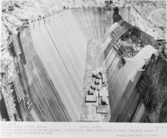
Film transparency of the Nevada spillway, Hoover Dam, August 29, 1933
Date
1933-08-29
Archival Collection
Description
Black and white image of Hoover Dam with the following printed description: "Looking upstream through Nevada spillway. Overflow weir under construction at right, completed section of channel lining and parapet at left." Note: Boulder Dam was officially renamed Hoover Dam in 1947.
Image
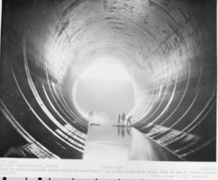
Film transparency of people standing in tunnel, Hoover Dam, December 27, 1938
Date
1938-12-27
Archival Collection
Description
Black and white image of Hoover Dam with the following printed description: "View of 50-foot diameter tunnel below Arizona Tunnel Plug outlet works with Stoney Gate at end of tunnel lowered." Note: Boulder Dam was officially renamed Hoover Dam in 1947.
Image

Photograph of businesses on Arizona Street, downtown Boulder City, Nevada, circa 1942 - 1940s
Date
1942 to 1949
Archival Collection
Description
View of businesses on Arizona Street in downtown Boulder City, taken from the corner of Nevada Highway and Arizona Street, looking east. Shell Service Station, Visitors Bureau, Boulder Theatre, Nava-Hopi Trading Post are seen. The front of the Boulder Dam Hotel is seen immediately east of the Nava-Hopi Store. Automobiles are in the street and parked in front of shops.
Image
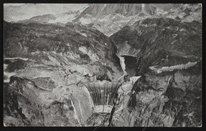
Postcard showing Hoover Dam construction, Boulder City (Nev.), 1940-1959
Date
1940 to 1959
Archival Collection
Description
Hoover Dam construction by Bureau of Reclamation, Boulder City, Nevada on postcard. Inscription on back: 'In Flight With United Air Lines. Mighty Boulder Dam and its vast lake are impressive sights for air travelers flying from New York, Chicago, and other cities to Los Angeles via United Air Lines."" (no handwriting or address on post card).
Image
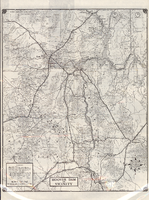
Road map of Hoover Dam and vicinity, circa 1949
Date
1947 to 1951
Description
'Cartography by W. C. Kainsinger, W.T. Taylor. Field mapping by K. R. Reed, G. Boyd. Typography by W. R. Williams.' 'Copyright by Automobile Club of Southern California. C-21351.' 'C-1352'--Panel. Index on verso. In lower right corner: 'Map number 1959.' Scale 1:415,210 (W 116°--W 114°/N 37°--N 35°). Relief shown by hachures and spot heights. Shows mines, ranches and springs. Not the same as the 1948 edition of this map. Cartographers', field mappers', typographers' names are different, and 2 out of 3 numbers on maps are different. Probably after 1947 as Boulder Dam has been changed to Hoover Dam, but before 1950 as Las Vegas Bombing and Gunnery Range has not been changed to Nellis Air Force Base. Automobile Club of Southern California.
Text
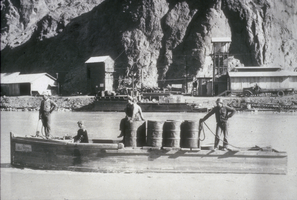
Slide of boats used in construction phase of Hoover Dam, January 10, 1932
Date
1932-01-10
Archival Collection
Description
Black and white image of boats used to transport men, powder, and supplies up and down the Colorado River in Black Canyon during the construction phase of the Boulder Canyon Project, better known as Hoover Dam. Note: Boulder Dam was officially renamed Hoover Dam in 1947.
Image
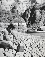
Photograph of mud deposit, Hoover Dam, March 14, 1939
Date
1939-03-14
Archival Collection
Description
Black and white image of a mud deposit at Hoover Dam. This site can be seen at mile 257, and a member of the survey crew displays a representative sample of one of the mud cubes formed to show the depth of the crevices. Note: Boulder Dam was officially renamed Hoover Dam in 1947.
Image
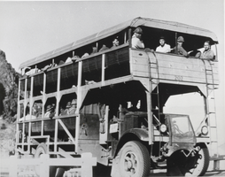
Photograph of motor transport, Boulder City, Nevada, April 12, 1934
Date
1934-04-12
Archival Collection
Description
Black and white image of "Big Bertha," the Six Companies, Inc. motor transport used to haul workmen between Boulder City and Hoover Dam. This double-decker truck could haul 154 men. Note: Boulder Dam was officially renamed Hoover Dam in 1947.
Image
Pagination
Refine my results
Content Type
Creator or Contributor
Subject
Archival Collection
Digital Project
Resource Type
Material Type
Place
Language
Records Classification
