Search Results
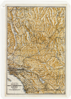
Map of a portion of southern California and southwestern Nevada, circa early 1930s
Date
1930 to 1934
Description
Subtitle: 'Embracing the arid region of Mojave & Colorado deserts including Death Valley.' In lower right-hand corner: '1379.' In lower left-hand corner: 'Burke-Douglas.' Relief shown by shading and spot heights. On verso: Indexes to cities, towns, junctions, resorts, springs, wells, tanks, waterholes, lakes, reservoirs, rivers and creeks, mountains, valleys, mines, canyons, passes, grades, deserts, flats and ranches. Includes mileage tables. 'Prepared by the Route and Map Service of the Automobile Club of Southern California'--Panel. On verso: Map showing roads and points of interest in Death Valley & vicinity. Scale [ca. 1:823,680]. 1 in. to approx. 13 miles (W 119°--W 114°/N 38°--N 33°)
Text


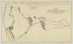
Map of an exploring expedition to the Rocky Mountains in the year 1842 and to Oregon & north California in the years 1843-44
Date
1845
Description
Scale 1:3,000,000. 47.35 miles to 1 in. (W 124°--W 94°/N 46°-- N 34°) ; 1 map ; 76 x 128 cm. ; Relief shown by hachures ; State 3: Includes notes, Great Basin statement, and place name South Park below Bayou Salade; some place names differ from other states ; Includes "Profile of the route from the mouth of the Kansas to the Pacific by Capt. J.C. Fremont in 1843." ; U.S. Senate
Image
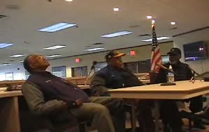
Video clip of interview with Oscar Foger, Wallace Morgan, and JD Davis
Archival Collection
Description
Part of the Nevada Test Site Oral History Project (MS-00818)
Moving Image
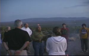
Video clip of drum circle with Corbin Harney
Archival Collection
Description
Part of the Nevada Test Site Oral History Project (MS-00818)
Moving Image
Audio recording clip of interview with Anonymous, 2004-2007
Date
2004 to 2007
Archival Collection
Sound

Interview with Marcell Eugene Bridges, June 12, 2004
Date
2004-06-12
Archival Collection
Description
Narrator affiliation: Downwinder (Salt Lake City, Utah)
Text
Audio recording clip of interview with Zenna Mae and Eugene Bridges by Mary Palevsky, June 12, 2004
Date
2004-06-12
Archival Collection
Description
Narrator affiliation: Downwinder (Salt Lake City, Utah)
Sound

Interview with Zenna Mae (Schmid) Bridges, June 12, 2004
Date
2004-06-12
Archival Collection
Description
Narrator affiliation: Downwinder (Salt Lake City, Utah)
Text