Search Results
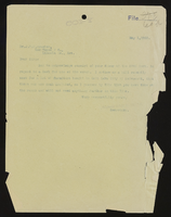
Las Vegas Ranch, Nevada (3 of 4)
Date
1903 to 1904
Archival Collection
Description
Series 1. San Pedro, Los Angeles and Salt Lake Railroad -- J. Ross Clark/Los Angeles Office Files
Mixed Content
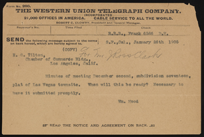
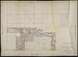
Town site
Date
1905
Archival Collection
Description
Series 1. San Pedro, Los Angeles and Salt Lake Railroad -- J. Ross Clark/Los Angeles Office Files
Mixed Content
Fruit packing house in Riverside, California
Date
1916 to 1920
Archival Collection
Description
Series 1. San Pedro, Los Angeles and Salt Lake Railroad -- J. Ross Clark/Los Angeles Office Files
Mixed Content
Bean warehouse in Hartville, California
Date
1916 to 1919
Archival Collection
Description
Series 1. San Pedro, Los Angeles and Salt Lake Railroad -- J. Ross Clark/Los Angeles Office Files
Mixed Content
LVLWC - proposed sale of water production facilities of UPRRC
Date
1952
Archival Collection
Description
Series 2. Las Vegas Land and Water Company -- General Manager, Manager of Properties, and Manager of Industrial Development in Los Angeles, California -- Las Vegas Land and Water Company (LVLWC) Corporate Documents, Reports, and Accounts
Mixed Content
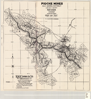
Map of Pioche mines, Ely Mining District, Lincoln County, Nevada, 1909
Date
1909
Description
'A.D. Knowlton, Mining Engineer, Pioche, Nevada; H.H. Snelgrove, Draftsman, Salt Lake City, Utah. Copyright 1909 Rufus K. Cobb.' Includes township and range grid; Includes wagon roads. Published by R.K. Cobb. Photocopy.
Image
Map of the Goldfield Mining District, Nye and Esmeralda Counties, Nevada, 1905
Date
1905
Description
Copyright 1905 by Elmer J. Chute, E.M. Goldfield, Nev. In lower right corner: "Designed and drawn by R.W. Griswold." Includes inset location map; Includes township and range grid. Scale [ca. 1:20, 400. 1 in.=aprrox. 1,700 feet]
Image
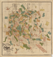
Map of U.S. patent and location surveys in the Goldfield Mining District, Esmeralda and Nye Counties, Nevada, 1907
Date
1907
Description
'Elmer J. Chute, E.M. and Olmstead & Rich. U.S. Deputy Mineral Surveyors, 1907. Copyright 1907 by Elmer J. Chute, E.M., Goldfield, Nev.' Includes index Includes township and range grid. Scale [ca. 1:22,800. 1 in. to approx. 1900 feet]
Text
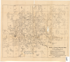
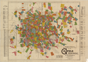
Map of the Goldfield Mining District, Goldfield, Nevada, 1907
Date
1907
Description
'Elmer J. Chute, E.M. and Olmstead and Rich, Goldfield, Nevada. Copyright 1907, by Elmer J. Chute, Goldfield, Nev.' Includes information on and prices for wall and pocket map with this title. Includes inset map. Includes township and range grid. Library's copy has Rochester GF. claim circled in blue ink , has a piece missing to the right of that claim, and has "Mohawk ledge, a lease by Davis & Shoemaker" written in blue ink at the center bottom of the map with a line in blue ink drawn to the Frances Mohawk claim.
Image

Map of Argentite Red Mountain Mining District, Esmeralda County, Nevada, circa 1908-1913
Date
1908 to 1913
Description
'Compiled by C. A. Liddell, U.S. Mineral Surveyor, Tonopah, Nevada, from surveys by Sherwin, Giles and Liddell.' Published between 1908-1913? Scale [ca. 1:7,200]. 1 in. equals 600 feet. Map printed on linen.
Image