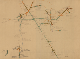
Search Results
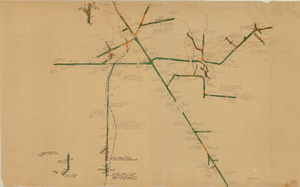
Map of the 380 foot level of the Combination Mine, Goldfield, Nevada, circa 1902-1908
Date
1902 to 1908
Description
'380 ft. level.' Hand-drawn, hand-colored and annotated map showing the 380 foot level of the Combination Mine.
Image
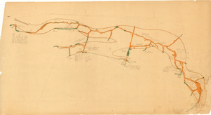
Map of the third level of the Red Top Mine, Goldfield, Nevada, circa 1902-1908
Date
1902 to 1908
Description
'Red Top 3rd level, 5659.90.' Hand-drawn, hand-colored and annotated map showing the third level of the Red Top Mine.
Image

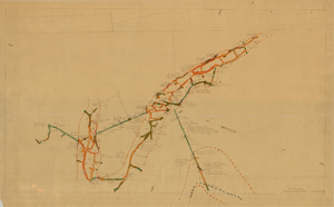
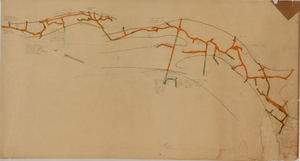
Map of the 328 foot level of the Combination Mine, Goldfield, Nevada, circa 1902-1908
Date
1902 to 1908
Description
Hand-drawn, hand-colored and annotated map showing the 328 foot level of the Combination Mine.
Image
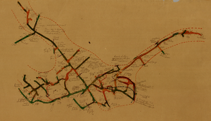
Map of the 130 foot level of the Combination Mine, Goldfield, Nevada, circa 1902-1908
Date
1902 to 1908
Description
'130 ft. level. Combination Mine.' 'Scale 1 in.=40 ft.' Hand-drawn, hand-colored and annotated map showing the 130 foot level of the Combination Mine.
Image
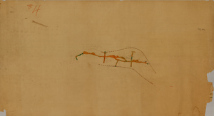
Map of the 330 foot level of the Combination Mine, Goldfield, Nevada, circa 1902-1908
Date
1902 to 1908
Description
Hand-drawn, hand-colored and annotated map showing the 330 foot level of the Combination Mine.
Image
Map of the 380 foot level of the Locke Mine, Goldfield, Nevada, circa 1902-1908
Date
1902 to 1908
Description
'380 ft. level.' Hand-drawn, hand-colored and annotated map showing the 380 foot level of the Locke Mine.
Image
Map of the fourth level of the Red Top Mine, Goldfield, Nevada, circa 1902-1908
Date
1902 to 1908
Description
'Red Top, 4th level. 5586.90.' Hand-drawn, hand-colored and annotated map showing the fourth level of the Rep Top Mine.
Image
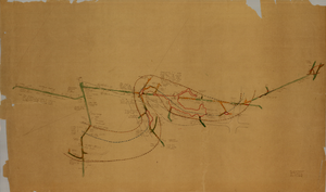
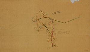
Map of the first level of the Red Top Mine, Goldfield, Nevada, circa 1902-1908
Date
1902 to 1908
Description
'Red Top, 1st level. 5820.30.' Hand-drawn, hand-colored and annotated map showing the first level of the Red Top Mine.
Image
Map of the fourth level of the Clermont Mine, elevation 5228.8 feet, Goldfield, Nevada, circa 1902-1908
Date
1902 to 1908
Description
'Clermont, 4th level, el. 5228.8.' Hand-drawn, hand-colored and annotated map showing the fouth level of the Clermont Mine.
Image
Map of the fifth level of the Clermont Mine, Goldfield, Nevada, circa 1902-1908
Date
1902 to 1908
Description
'Clermont, 5th level, el. 5098.2.' Hand-drawn, hand-colored and annotated map showing the fifth level of the Clermont Mine.
Image