Search the Special Collections and Archives Portal
Search Results
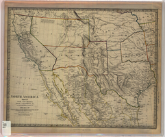
Map of Utah, New Mexico, Texas, California, Indian territory, and the northern states of Mexico, 1852
Date
1852-01-01
Description
At head of title: 'North America, sheet XV.' 'Published under the superintendence of the Society for Diffusion of Useful Knowledge.' At bottom center of map:'London, Charles Knight, Jany. 1st, 1852.' At bottom right of map: ' J. & C. Walker Sculpt.' Scale [1:7,500,000] 1 degree to 68.89 English miles (W 125°--W 92°/N 43°30?--N 22°30?). Relief shown by hachures. Atlas page number in lower margin: 144. Boundaries hand colored. Includes notes, locations of Indian tribes, population statistics. Charles Knight.
Image
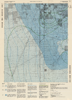
Topographic map of groundwater in the southwest quadrangle of Las Vegas, Nevada, 1985
Date
1985
Description
'Las Vegas Area Map 3Bf.' 'Prepared in cooperation with the U.S. Geological Survey.' ' Water Resources Division, U.S. Geological Survey, Carson City, Nevada.' Scale 1:24,000 (W 115°15´00?--W 115°07´30? / N 36°07´30?--N 36°00´00?). Series: Las Vegas area map ; 3Bf. Urban area maps. Las Vegas area map ; 3Bf. Relief shown by contour lines and spot heights. Title in right and left margins: Las Vegas SW quad : ground water. Title on publications list on Nevada Bureau of Mines and Geology website: Groundwater map of the Las Vegas SW quadrangle. Series: Urban area maps [Las Vegas area map] from list of publications on Nevada Bureau of Mines and Geology website. Nevada Bureau of Mines and Geology
Text
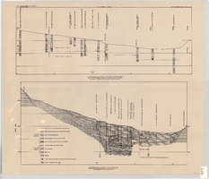
Cross-sections of wells and aquifers in the Las Vegas Valley, circa 1946
Date
1943 to 1949
Description
2 map sections on 1 sheet. Originally published as plate 6 in Geology and water resources of Las Vegas, Pahrump, and Indian Spring Valleys, Clark and Nye Counties, Nevada by George B. Maxey and C.H. Jameson, which is number 5 of the Water resources bulletin published by the Nevada Office of the State Engineer. Shows permeable and impermeable materials, wells, and aquifers.
Text
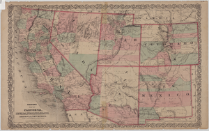
Map of California, Nevada, Utah, Colorado, Arizona & New Mexico, circa 1867
Date
1865 to 1869
Description
39 x 62 cm. Relief shown by hachures and spot heights. Prime meridian: Greenwich and Washington. Hand colored. Shows natural features, populated places, routes of mail steamships, routes of explorers, locations of Indian tribes, railroad routes, and proposed railroad routes. In top margin: No. 80-81. On verso: New Mexico, Arizona, Colorado, Idaho, Dakota (statistics and other information) and The state of California (statistics and other information). Original publisher: G.W. and C.B. Colton.
Image
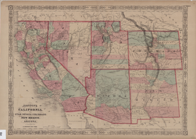
Map of California, Utah, Nevada, Colorado, New Mexico and Arizona, circa 1867
Date
1865 to 1869
Description
39 x 56 cm. Relief shown by hachures. "Entered according to act of Congress in the year 1864, by A.J. Johnson in the Clerks Office of the United States for the Southern District of New York." Atlas page numbers in upper margin: 67-68. Primer meridians: Greenwich and Washington, D.C. On verso: History and statistical view of the West India islands or Columbian Archipelago and Historical and statistical view of Mexico and Central America. Shows proposed railroads, locations of Indian tribes, natural features, counties, mines, mail routes, trails and routes of exploring expeditions. Has decorative border. Southern part of Nevada was added to the state in 1867 and is part of Nevada on this map, but Lincoln County was established in 1867 and is not on this map. This map was still probably published in 1867 in spite of someone's having written "1864" in pencil in the lower right corner of the Library's copy. Original publisher: A.J. Johnson.
Image
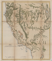
Map showing the different routes travelled over by the detachments of the Overland Command in the spring of 1855 from Salt Lake City, Utah, to the Bay of San Francisco, 1855
Date
1855
Description
57 x 47 cm., folded to 22 x 13 cm. Indicates routes of Capt. Ingalls, Col. Steptoe,and Lt. Mowrey, and shows camping grounds. Relief shown by hachures. Graphic scale given in geographical as well as statute miles. "Ackerman Lith. 319 Broadway, N.Y." Hand colored. Original publisher unknown, Series: House Ex. Doc. No. 1, 1st session, 34th Congress.
Image
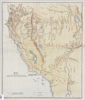
Map showing the different routes travelled over by the detachments of the Overland Command in the spring of 1855 from Salt Lake City, Utah, to the Bay of San Francisco, 1855
Date
1855
Description
57 x 47 cm. Indicates routes of Capt. Ingalls, Col. Steptoe, and Lt. Mowrey, and camping grounds. "Ackerman Lith. 319 Broadway, N.Y." Relief shown by hachures. In Wheat, "Mapping of the Trans-Mississippi West", v. 4, p. 210. Library's copy 1 is poor quality and not in color. Original publisher unknown, Series: Senate Ex. Doc. No. 1, 1st session, 34th Congress.
Image
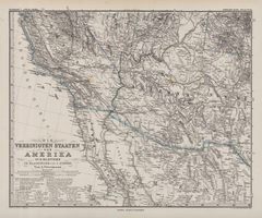
Die Vereinigten Staaten von Amerika in 6 Blättern im Maassstabe von 1:3,700,000
Date
1882
Description
33 x 41 cm. Relief shown by hachures and spot heights. Prime meridian: Greenwich. Sheet 4 of a 6-sheet map. "Petermann: ver. st. v. am. bi. 4". "Stieler's Hand Atlas, No. 86." Binder's title of Hand Atlas über alle Thiele der Erde und über das Weltgebäude, which was published in 1879. In German. Library has only map of Arizona and parts of surrounding states and northern Mexico. Original publisher: Justus Perthes.
Image
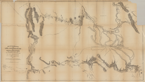
Map based on reconnaissance of the Zuñi, Little Colorado and Colorado Rivers in 1851 by U.S. Corps of Topographical Engineers
Date
1852
Description
Transcribed from the original: 'Made in 1851 under the direction of Col J.J. Abert, Chief of Corps Topographical Engineers, by BVT. Capt. L. Sitgreaves, T.E., assisted by Lieut. J.G. Parke, T.E., and Mr. M.H. Kern. Drawn by R.H. Kern, 1852.' 'Gila River from a reconnaissance by Maj. Emory, Topographical Engrs. Colorado River below Camp Yuma from a reconnaissance by Lt. Derby Topographical Engrs.' Shows Indian villages and forts. Upper right corner partially missing. Scale [ca. 1:650,000]. Scale of 10 miles to one inch.' 'Ackerman Lith.: 379 Broadway, N.Y.'
Image

Map of the progress of the transcontinental triangulation and reconnaissance eastward from the Pacific Coast, June 30, 1883
Date
1883-06-30
Description
26 x 93 cm. "Coast and Geodetic Survey report, 1883, no. 23." "June 30, 1883." Original publisher: U.S. Coast and Geodetic Survey, Scale: 1: 2000 000.
Image
Pagination
Refine my results
Content Type
Creator or Contributor
Subject
Digital Project
Resource Type
Material Type
Place
Language
