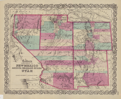
Search the Special Collections and Archives Portal
Search Results
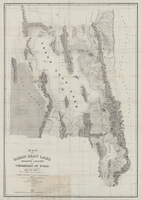
Map of the Great Salt Lake and adjacent country in the territory of Utah, 1850
Date
1849 to 1850
Description
108 x 75 cm. Map part hand colored. Relief shown by hachures and depths shown by soundings. Accompanies U.S. Army. Corps of Topographical Engineers. Exploration and survey of the valley of the Great Salt Lake of Utah. "Map of the Great Salt Lake and adjacent country in the Territory of Utah. Surveyed in 1849 and 1850, under the orders of Col. J. J. Abert, Chief of the Topographical Bureau, by Capt. Howard Stansbury of the Corps of Topographical Engineers, aided by Lieut. J. W. Gunnison Corps Topographical Engineers and Albet Carrington. Drawn by Lieut. Gunnison and Charles Preuss. Ackerman lith 379 Broadway N. Y." Original publisher: Ackerman Lith. Scale: 1:240,000.
Image
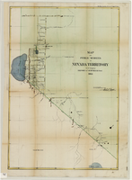
Map of public surveys in Nevada Territory to accompany report of Surveyor General, October 1, 1862
Date
1862-10-01
Description
'Surveyor Generals Office. San Francisco California October 1st 1862. [signed] E.F. Beale, U.S. Surv. Genl. Nevada Terry.' In upper right corner: 'Ho. Reps. Ex. Doc. No. 1. 37th Cong. 3d. Sess.' Relief shown by hachures. Scale [1:253,440] 1 in. to 4 miles (W 120°08--W 118°40/N 39°45--N 38°00)
Image
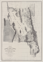
Map of the Great Salt Lake and adjacent country in the territory of Utah, 1852
Date
1852
Description
85 x 58 cm. "Available from the University of Utah Press, Salt Lake City, Utah 84112." Relief shown by hachures and spot heights; depths shown by soundings. "Scale 1:240,000"--inapplicable due to reproduction. Originally published to accompany Stansbury's report, Exploration and survey of the valley of the Great Salt Lake of Utah published in 1852 for the United States Army's Corps of Topographical Engineers. Includes text. Original publisher: University of Utah Press, Scale 1:240,000.
Image
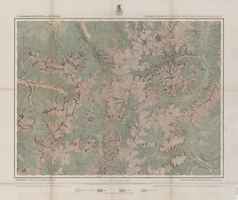
Map of economical features of Southwest Colorado, San Juan mining region, circa 1877
Date
1872 to 1880
Description
37 x 49 cm. Relief shown by hachures and spot heights. "Atlas sheet no. 61(C)." "Expeditions of 1874 & 1875 under the command of 1st. Lieut. Geo. M. Wheeler, Corps of Engineers, U.S. Army." "Louis Nell, del." "By order of the honorable the Secretary of War." "Under the direction of Brig. General A. A. Hunphreys, Chief of Engineers, U. S. Army." Original publisher: U.S. Geographical Surveys West of the 100th Meridian, Scale: 1 inch to 2 miles or 1: 126720.
Image
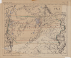
Map of territory of Utah, 1857
Date
1857
Description
31 x 39 cm. Relief shown by hachures and spot heights. "Entered in Sta. Hall London & according to act of Congress in the year 1857 by H.D. Rogers in the Clerks Office of the District Court of Massachusetts." Includes proposed Pacific railway routes. In upper margin: Atlas of United States &c., 13. Original publisher: John Murray, Scale: 3,450,000 of nature, 54 1.
Image
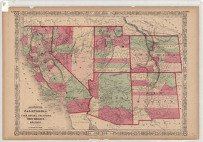
Map of California, and territories of Utah, Nevada, Colorado, New Mexico and Arizona, 1864
Date
1864
Description
'Johnson's California, also Utah, Nevada, Colorado, New Mexico, and Arizona, published by A.J. Johnson, New York.' 'Entered according to act of Congress in the year 1864, by A.J. Johnson in the Clerks Office of the District Court of the United States for the southern district of New York.' Atlas page numbers in upper margin: 67-68. Relief shown by hachures. Prime meridian: Greenwich and Washington. Shows natural features, locations of Indian tribes, proposed railroad routes, routes of explorers, trails, county boundaries and populated places. Hand colored. On verso: 'Historical and statistical view of the West India Islands or Columbian Archipelago' (p. 80) and 'Historical and statistical view of Mexico and Central America' (p. 79). Scale [ca. 1:3,484,800]. 1 in. to ca. 55 miles (W 124°--W 102°/N 42°--N 32°).
Text
Pagination
Refine my results
Content Type
Creator or Contributor
Subject
Digital Project
Resource Type
Material Type
Place
Language

