Search Results
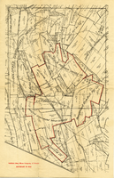
Map of mines owned and operated by Goldfield Deep Mines Company of Nevada, circa 1904-1908
Date
1904 to 1908
Description
Printed on map: 'Boundary in red.'
Image
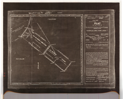
Plat of the Texas and Lone Star Lodes, May, 1905
Date
1905-05
Description
'Plat of the claim of the Rochester Goldfield Mining Company known as the Texas and Lone Star Lodes, in Goldfield Mining District, Nye County, Nevada containing an area of 36.121 acres. Scale of 300 feet to the inch. Variation 17° east. Surveyed May 6-18, 1905, by H. F. Bruce, U.S. Deputy Mineral Surveyor.' Certification signed by Matthew Kyle, U.S. General Surveyor's Office, Reno, Nevada, November 11, 1905. 'Claim located February 3, 1904; amended December 28, 1904.' 'Mineral Survey No. 2330.' At top of plat: 'Vol 459, P 133, No 45841.'
Text
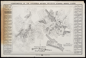
Map of Rawhide Mining District, Nevada, circa 1908
Date
1905 to 1911
Description
'Numbers and black lines show locations of the principal mines, prospects and leases of Rawhide.' 'Compiled by Engraving Department of the Goldfield Review. Olmstead and Rich, Mining Engineers, Goldfield, Nevada.' At top of map: 'Compliments of the Goldfield Review, Nevada's leading mining paper.' Includes index. Published by Goldfield Review Press.
Text

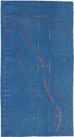
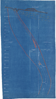
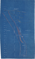
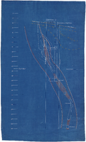
Cross-section maps of Combination and Florence Mines, Goldfield, Nevada, circa 1902-1908
Date
1902 to 1908
Description
Maps of Combination and Florence Mines, Goldfield, Nevada.
Image