Search the Special Collections and Archives Portal
Search Results

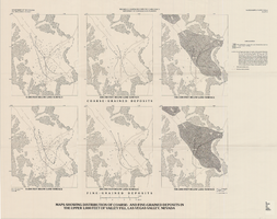
Maps showing distribution of coarse- and fine-grained deposits in the upper 1,000 feet of valley fill, Las Vegas Valley, Nevada, 1981 (Water-supply paper 2320-A, plate 3)
Date
Description
2320-A. Originally published as plate 3 of Ground-water conditions in Las Vegas Valley, Clark County, Nevada. Part I. Hydrogeologic framework / by Russell W. Plume, published by the U.S. Geological Survey in 1989 as Water-supply paper 2320-A.United States Dept. of the Interior, Geological Survey.
Image

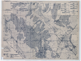
General geologic map of Las Vegas, Pahrump, and Indian Spring Valleys, Clark and Nye Counties, Nevada, 1948
Date
Description
At top of map: 'United States Department of the Interior, Geological Survey. State Engineer of Nevada. Water resources bulletin No. 5, Plate 1.' Relief shown by spot heights. Includes 3 inset maps of wells and springs in the vicinity of Pahrump, Manse Ranch and Indian Springs, Nevada. Scale [ca. 1:126,720. 1 inch to approx. 2 miles] (W 116°--W 115°/N 40°--N 36°). Originally published as plate 1 in Geology and water resources of Las Vegas, Pahrump, and Indian Spring Valleys, Clark and Nye Counties, Nevada by George B. Maxey and C.H. Jameson (1948), which is number 5 of the Water resources bulletin published by the Nevada Office of the State Engineer.
Image

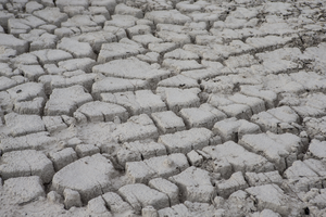
Images from the Lake Mead National Recreation Area with the lowest water levels since the 1950s taken July 16, 2014: digital photographs
Date
Archival Collection
Description
Image
Water Law in the West: A Panel Discussion with Patricia Mulroy held in the Thomas and Mack Moot Court facility on September 26, 2013: digital photographs
Date
Archival Collection
Description
Image
Las Vegas Valley Water District (LVVWD) Contract Number 110, Construction of Sandhill-Tropicana Transmission Main with Survey Control and Cost Estimate, 1967
Level of Description
Archival Collection
Collection Name: Gilbert Buck Papers
Box/Folder: Box 02
Archival Component
"Ground-Water Flow Systems and Underground Nuclear Testing." American Institute of Mining, Metallurgical, and Petroleum Engineers, Inc., 1970
Level of Description
Archival Collection
Collection Name: University of Nevada, Las Vegas Faculty Publications
Box/Folder: Box 04
Archival Component
208 Water Quality Management Plan, Clark County, Nevada: Laughlin Amendment by Black & Veatch Engineers-Architects, 1990 March 19
Level of Description
Archival Collection
Collection Name: Clark County 208 Water Quality Management Plan Records
Box/Folder: Box 01
Archival Component
Water Studies for Miro Mizera, Ali Baba Apartments, Regency Manor, and the Comprehensive Mental Health Center, all in Las Vegas, Nevada, 1969-1970
Level of Description
Archival Collection
Collection Name: Gilbert Buck Papers
Box/Folder: Box 03
Archival Component
"Voice of the West" resolutions adopted report of the Water Policy Committee at National Reclamation Association, 27th Annual Meeting, 1958 November 19-21
Level of Description
Archival Collection
Collection Name: A. J. Shaver Papers
Box/Folder: Box 01
Archival Component
The impact of a water-imposed interruption of growth in the Las Vegas region (Executive Summary), prepared by William T. White, Thomas M. Carroll, and R. Keith Schwer, 1992 November
Level of Description
Archival Collection
Collection Name: Citizen Alert Records
Box/Folder: Box 05
Archival Component
