Search the Special Collections and Archives Portal
Search Results
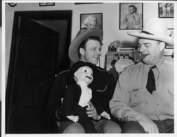
Rex Bell and Bill Froelich at Walking Box Ranch: photographic print
Date
Archival Collection
Description
Dorothy Bell Scans UNLV-Public Lands Institute. Photograph of Rex Bell (George Francis Beldam) and Bill Froelich with dummy Charlie McCarthy at the bar of the game room in the ranch house at Walking Box Ranch.
Image
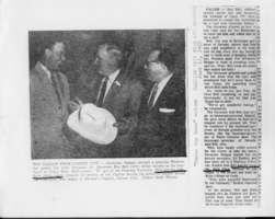
Newspaper clipping of Lt. Gov. Rex Bell giving a hat to North Carolina governor Luther Hodges in Raleigh, North Carolina: photographic print
Date
Archival Collection
Description
Dorothy Bell Scans UNLV-Public Lands Institute
Text
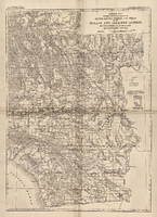
General map showing approximate location of better known springs and wells in the Mohave and adjacent deserts, southeastern California and southwestern Nevada, circa 1908-1909
Date
Description
224. Map is plate 1 from the U.S. Geological Survey Water-supply paper 224.
Image
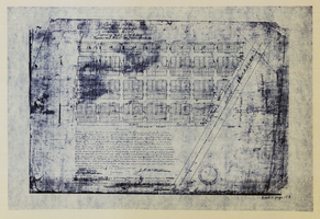
Original plat, townsite of Las Vegas, Lincoln Co., Nevada, January 13, 1905
Date
Description
Subtitle: 'Embracing the N. 1/2 of S.W. 1/4 Sec. 27 Township 20S. R.61E. Mt. Diablo Meridian.' 'Book 1, page 17A" handwritten in lower right corner. Signed by Henry Lee, County Recorder, Lincoln County Nevada. 'Filed at request of J.T. Williams, January 13th A.D. 1905.' Backwards handwriting on right side. Map has a Lincoln County seal on the bottom near the center. In the dedication J.T. McWilliams states that he has surveyed and platted the townsite of Las Vegas subject to the right of way of the San Pedro, Los Angeles and Salt Lake Railroad Company. He signed the dedication on Jan. 13, 1905, and it was signed by witnesses Scale [ca. 1:2,520? 1 inch to approx. 210 feet?]. Copy of a blueline print.
Image
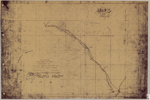
Map showing right of way of toll road constructed by Nevada Rapid Transit Co. in Lincoln County, State of Nevada
Date
Description
Image
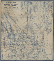
Miners map of Death Valley and the proposed Salt Lake railroads, January 1903
Date
Description
Image

Correspondence, Page, McCutchen, Harding and Knight to H.E. George
Date
Archival Collection
Description
Text

Correspondence, Emily Rice to Sadie George
Date
Archival Collection
Description
Text

Correspondence, F.R. McNamee to H.E. George
Date
Archival Collection
Description
Text
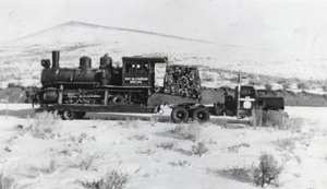
First and only train to run through the Smoky Valley: photographic print
Date
Archival Collection
Description
From the Nye County, Nevada Photograph Collection (PH-00221) -- Series V. Smoky Valley, Nevada and Round Mountain, Nevada -- Subseries V.A. Carver, Carver-Duhme, and Carver-Book Families (Smoky Valley). Doby Doc Caudill lived in Carlin, Nevada, and had amassed a large collection of memorabilia of early Nevada history. He later sold his collection to the Last Frontier Casino in Las Vegas. One of the items in Doby Doc’s collection was this old steampowered locomotive, which was hauled to Las Vegas by way of Highway 50 and the Round Mountain turnoff out of Austin, then on to Tonopah and Las Vegas. The side of the train says "PAT McCARRAN SPECIAL".
Image
