Search Results
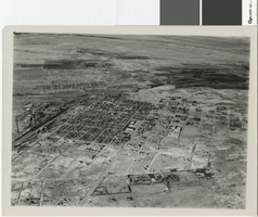
Aerial photograph of Las Vegas, 1920s
Date
Archival Collection
Description
Aerial view of Las Vegas looking northwest over the Union Pacific Railroad yards.
Image
Brian Jones Collection of Henderson, Nevada Aerial Photographs
Identifier
Abstract
The Brian Jones Collection of Henderson, Nevada Aerial Photographs contain 107 4"x6" photographic prints of Henderson, Nevada and the surrounding area from approximately 1997 to 2002 taken by longtime Las Vegas, Nevada photographer Brian Jones. Images depict the construction of residential areas, roads, and commercial buildings. Other images include the Green Valley community, Galleria at Sunset Mall, St. Rose Dominican Hospital, Titanium Metals Corporation (TIMET), and Henderson City Hall. Lastly, there are images of parking lots, industrial areas, and airport runways in Henderson and Las Vegas, Nevada.
Archival Collection
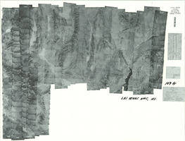
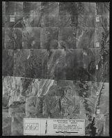
Index to aerial photographs of Las Vegas, Nevada: photographic print
Date
Archival Collection
Description
Image
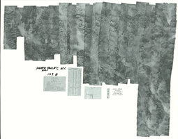
Index to aerial photographs of Death Valley, Nevada: photographic print
Date
Archival Collection
Description
Image
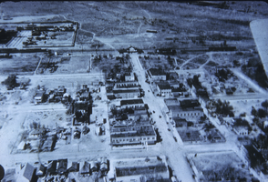
Aerial downtown, undated
Level of Description
Archival Collection
Collection Name: Jacob E. Von Tobel Photograph Collection
Box/Folder: Folder 02
Archival Component
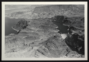
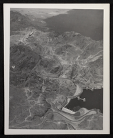
Aerial photograph of Hoover Dam, circa mid 1930s
Date
Archival Collection
Description
Image
Aerial view of the Bonelli quadrant in Arizona-Nevada: photographic print
Date
Archival Collection
Description
Image
Aerial view, undated
Level of Description
Archival Collection
Collection Name: Elbert Edwards Photograph Collection
Box/Folder: Folder 20
Archival Component
Aerial photograph of Hoover Dam, circa 1933-1935
Date
Archival Collection
Description
Image
Slide of aerial view of Las Vegas, circa early 1900s
Date
Archival Collection
Description
Image