Search Results
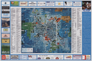
Aerial map of the Las Vegas Valley, with map of Las Vegas, 1992
Date
1992
Description
2 maps on 1 sheet : both sides, col. ; 47 x 51 cm. and 54 x 71 cm. on sheet 61 x 91 cm. Photomap. Includes text about Las Vegas, list of businesses with coordinates for map on verso, and advertisements. On verso: Bird's-eye view map of a section of unincorporated Las Vegas east of the Strip between Charleston and Sunset oriented with north to left and drawn by Jack Tavenner in 1992. Shows locations of schools, lists Boulder City merchants, and includes advertisements. Original Publisher: Landiscor Aerial Photo
Image
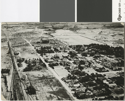
Aerial photograph of Las Vegas in the 1920s
Date
1920 (year uncertain)
Archival Collection
Description
Aerial photograph of Las Vegas looking north.
Transcribed Notes: Transcribed from photo sleeve: "Aerial views of Las Vegas showing downtown UP yards 1920's. Shop's still standing (1983)."
Image
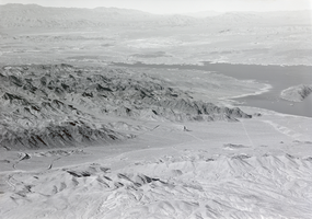
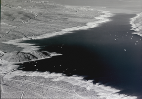
Film transparency of an aerial view of Lake Mead, circa 1930s
Date
1934 to 1939
Archival Collection
Description
Aerial view of Lake Mead and its shoreline.
Image
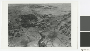
Aerial photograph of Las Vegas, 1931
Date
1931
Archival Collection
Description
Aerial view of Las Vegas looking southwest
Transcribed Notes: Notes from photo sleeve: "Aerial view of Las Vegas, Nevada, 1931. At left center is Clark Townsite; at right edge is McWilliams Townsite."
Image
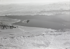
Film transparency of an aerial view of Lake Mead, circa 1930s
Date
1934 to 1939
Archival Collection
Description
Aerial view of Lake Mead and its shoreline.
Image
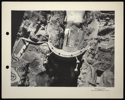
Aerial photograph of Hoover Dam, circa 1935-1936
Date
1935 to 1936
Archival Collection
Description
An aerial view of Boulder Dam with open jet flow gates (outlet works). Name officially changed to Hoover Dam in 1947.
Image
Film transparency of an aerial view of Lake Mead, circa 1930s
Date
1930 to 1939
Archival Collection
Description
Aerial view of Lake Mead and its shoreline.
Image
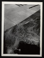
Aerial photograph of Hoover Dam, circa 1933-1935
Date
1934 to 1935
Archival Collection
Description
Aerial view of the nearly completed Hoover Dam in Black Canyon prior to the release of water.
Image
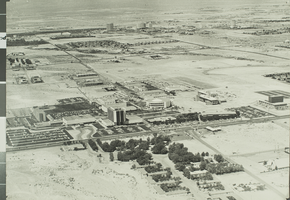
Aerial photograph of University of Nevada, Las Vegas, circa 1972
Date
1972
Archival Collection
Description
An aerial view of the University of Nevada, Las Vegas (UNLV). The Las Vegas Strip is visible in background.
Image
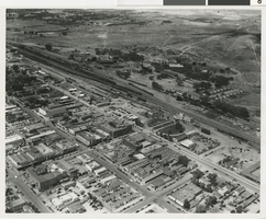
Aerial photograph of Las Vegas (Nev.), circa 1940
Date
1939 to 1941
Archival Collection
Description
Aerial view of depot yards, roundhouse, and shops in the growing city of Las Vegas.
Image