Search Results
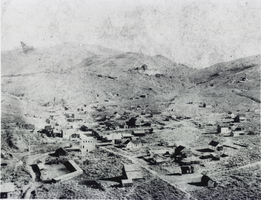
Aerial photograph of Aurora, Nevada, circa 1860s-1910s
Date
1860 to 1919
Archival Collection
Description
Aerial view of the mining town of Auora, Nevada, founded in 1860.
Image
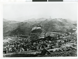
Aerial photograph of Virginia City, Nevada, 1870-1875
Date
1870 to 1875
Archival Collection
Description
A aerial view of Virginia City before the fire of 1875.
Image
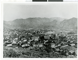
Aerial photograph of Virginia City, Nevada, 1870-1875
Date
1870 to 1875
Archival Collection
Description
A aerial view of Virginia City before the fire of 1875.
Image
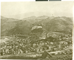
Aerial photograph of Virginia City, Nevada, 1870-1875
Date
1870 to 1875
Archival Collection
Description
A aerial view of Virginia City before the fire of 1875.
Image
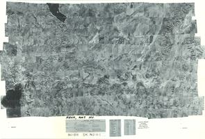
Index to aerial photographs of Reno, Nevada: photographic print
Date
1952 to 1954
Archival Collection
Description
From the Army Mapping Service Aerial Photographs of Southern and Western Nevada (PH-00285). Aerial photographs, composites, and indices. Geological Survey, Army Map Service. Western United States. Project No. 22502-569. Contract No. DA-49-018eng 1404. Lot BH. Sheet NJ 11-1.
Image
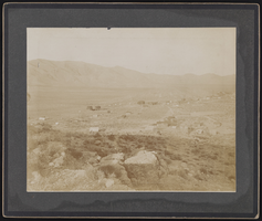
Aerial photograph of Goodsprings (Nev.), 1912
Date
1912
Archival Collection
Description
Aerial image of Goodsprings, Nevada in 1912.
Image
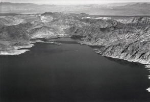
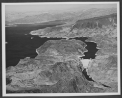
Aerial photograph of Lake Mead, circa 1935-1950
Date
1935 to 1950
Archival Collection
Description
An image showing an aerial view of Lake Mead.
Image
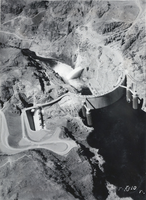
Aerial photograph of Hoover Dam, circa 1930-1949
Date
1930 to 1949
Archival Collection
Description
An aerial view of Hoover Dam.
Image
Aerial photograph of Hoover Dam, circa mid to late 1900s
Date
1950 to 1999
Archival Collection
Description
An aerial view of Boulder Dam.
Image
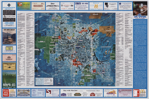
Aerial map of the Las Vegas Valley, with map of Las Vegas, 1992
Date
1992
Description
2 maps on 1 sheet : both sides, col. ; 47 x 51 cm. and 54 x 71 cm. on sheet 61 x 91 cm. Photomap. Includes text about Las Vegas, list of businesses with coordinates for map on verso, and advertisements. On verso: Bird's-eye view map of a section of unincorporated Las Vegas east of the Strip between Charleston and Sunset oriented with north to left and drawn by Jack Tavenner in 1992. Shows locations of schools, lists Boulder City merchants, and includes advertisements. Original Publisher: Landiscor Aerial Photo
Image