Search Results
Map of Nevada, circa 1909
Date
Description
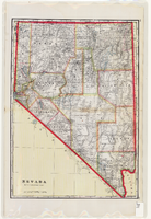
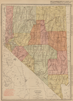
'Geo. F. Cram, engraver and publisher.' Scale [ca. 1:1,584,000. 1 in. to approx. 25 miles] (W 120°--W 114°/N 42°--N 35°). Relief shown by hachures and spot heights. Counties outlined in color. Shows railroads, forest reserves, mines, Indian reservations, and springs. Shows range and township grid. Indexes on verso to both Nevada and Utah maps. Atlas p. numbers in right margin: 124-125. G.F. Cram.
Mixed Content
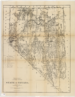
Map of Nevada, 1876
Date
Description
Image
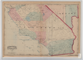
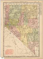
Map of southern California and southern Nevada, 1872
Date
Description
Image
Official road map of the State of Nevada, 1941
Date
Archival Collection
Description
Image
Map showing railroads in Nevada, 1911
Date
Description
Text
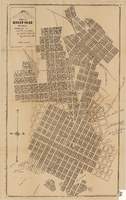
Map of Goldfield, Nevada, April 25, 1907
Date
Description
Image
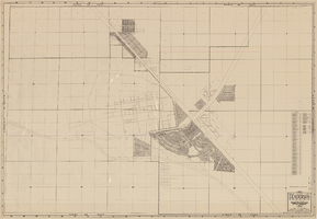
Map, city of Henderson, Nevada, August 1, 1955
Date
Description
Image
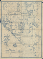
Automobile road map of the state of Nevada, circa 1930
Date
Description
Text
Law School Study for the University of Nevada, Las Vegas from Southwestern-Nevada Law Review
Date
Archival Collection
Description
A loose paper version of "Law School Study for the University of Nevada, Las Vegas" by Willard H. Pedrick and Lorne Seidman, photocopied from the Southwestern-Nevada Law Review, Volume 10, 1978. From the University of Nevada, Las Vegas William S. Boyd School of Law Records (UA-00048).
Text
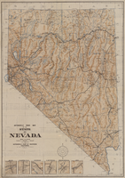
Rand-McNally new commercial atlas map of Nevada, 1912
Date
Description
Image